DDiscover AloneMapAbout

Cave in Dunkerron

Cave

What is recorded here

The blocked entrance to a drystone-built Man-made underground passage (KE092-035002-) is located in the NW internal wall-face of the N hut. Access is now gained about 3m to NW, through an opening formed by the removal of a number of roofing slabs of a NW-SE aligned passage. This passage, with slightly corbelled walls,…

Read the whole record
The blocked entrance to a drystone-built Man-made underground passage (KE092-035002-) is located in the NW internal wall-face of the N hut. Access is now gained about 3m to NW, through an opening formed by the removal of a number of roofing slabs of a NW-SE aligned passage. This passage, with slightly corbelled walls, extends for 9.6m and is .8m wide and .45m high. Collapse has considerably raised its floor level. At its NW end it turns towards W for a distance of 3.8m. Its N side-wall is regularly coursed, while that at S is formed from bedrock. Here the passage increases to 1.35m in height and 1m in width. At its W end is a lintelled creepway, .85m long, .55m wide and .6m high, the S side of which is formed by a single thick slab, set on end. The creepway gives access to another passage which continues W for a further 3.15m. A possible air vent is located midway along its S side. The passage, with coursed drystone walls which incline slightly inwards towards the roof, measures 1.4m high and .9m wide. It broadens at its W end, where it gives access at NW to an irregularly shaped natural limestone cave, 5.45m N-S x 6.3m E-W, which is host to a colony of bats (Rhinolophus hipposideros; information: M. O'Sullivan). The cave is on average 1m high, and features an uneven bedrock floor which slopes down to SE. A narrow rock-cut passage, 2.5m long, extends from its W end and leads into a small rectangular chamber, apparently also of natural origin. It measures approximately 3m by 1.5m. An accumulation of earth prevents access to its interior. A number of human bones removed from the floor of the larger cave in 1991 were identified as those of an adult aged at least thirty years (information: C. Power, UCC). Other bones, also reputedly human, were recovered from the cave in 1953 and were sent to England for 'inspection' (OPW). Cork University Press (1996), no. 583.

From the National Monuments Service (Archaeological Survey of Ireland) record KE092-035005

The monument record does not grant public access. Check the route and ask the landowner before entering private land.

What do you know about this place?Tap to add a comment or ask a question

What you write will be public.

Places near here

Photo credits
  • Mike Searle, Wikimedia Commons · CC BY-SA 2.0
  • National Inventory of Architectural Heritage
  • Nigel Cox, Wikimedia Commons · CC BY-SA 2.0
  • Vadim Manuylov, Wikimedia Commons · CC BY-SA 3.0
  • P L Chadwick, Geograph · CC BY-SA 2.0
  • Ulrich Hartmann, Geograph · CC BY-SA 2.0
  • Espresso Addict, Wikimedia Commons · CC BY-SA 2.0
Hut site in DunkerronHut site · 8 ydDunkerron CastleCastle · 478 ydDunkerron Island EastIslet · 1234 ydDromquinna ManorCountry house · 1500 yd

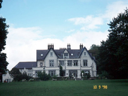
Explorer Tom Dromquinna Manor would use a lotto win to install more dormer windows and buy a very large dog. Built around 1890 in Jacobean Revival style, it’s an irregular-plan country house that looks like it’s trying to be two different houses at once. The limestone ashlar porch is probably judging your footwear choices. Bring a pen pal, they'll be jealous.

Enclosure in Killaha EastEnclosure · 1.2 mi

Explorer Tom Enclosure in Killaha East would tell a teenager that 1800s was basically your grandpa's boring phase. It’s only visible from the sky, which is very dramatic for a dirt circle. Whisper a secret at it, it's kept worse.
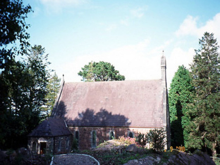
Dawros Catholic ChurchChurch/chapel · 1.5 mi

Explorer Tom Dawros Catholic Church is telling secrets after a few pints, likely about the bellcote or the purple slate roofs. Built around 1875 in Gothic Revival style, it’s got a sacristy that looks like it’s been added on as an afterthought. It probably thinks it’s more mysterious than it actually is. Ideal for a moody photo you'll pretend wasn't posed.

Kenmare Stone CircleVisitor attraction · 1.6 miKenmare Tourist Information OfficeVisitor information · 1.8 miMonterey Cypress1.8 mi

Explorer Tom This Monterey Cypress in County Kerry confused the map makers so badly they gave up and drew a circle. It’s definitely not where you think it is. Tell it a joke, it's been a long time since anyone did.

The Lodge WoodWood · 2.0 miDinish IslandIslet · 2.2 miStrickeenMountain / peak · 2.5 mi

More caves in County Kerry · All of County Kerry

Add to this placeAdd a picture Add a detailed tip Add a story

Explore the map1,093,392 places to discover

Next place · or swipeHut site in Dunkerron