What is recorded here
In S half of ringfort (CO070-050001-). Marked ‘Cave’ on the OS 6-inch first edition map. Macroom Historical Society members recorded a narrow passage which had caved in (Southern Star, 1/5/1982). A ‘spacious subterranean cavern’ is also mentioned by Lewis (1837, vol. 2, 329) who noted that 'several pieces of iron and other metal, much corroded, and apparently portions of ancient military weapons, have frequently been found here; the entrance has been lately closed up, to prevent accidents to cattle'. The interior of the ringfort is uneven, otherwise no visible surface trace.
In S half of ringfort (CO070-050001-). Marked ‘Cave’ on the OS 6-inch first edition map. Macroom Historical Society members recorded a narrow passage which had caved in (Southern Star, 1/5/1982). A ‘spacious subterranean cavern’ is also mentioned by Lewis (1837, vol. 2, 329) who noted that 'several pieces of iron and other metal, much corroded, and apparently portions of ancient military weapons, have frequently…
From the National Monuments Service (Archaeological Survey of Ireland) record CO070-050002
The monument record does not grant public access. Check the route and ask the landowner before entering private land.
- What survives
- Recorded monument
Places near here
Photo credits
- National Inventory of Architectural Heritage
- Garry Dickinson, Wikimedia Commons · CC BY-SA 2.0
- Donald MacDonald, Geograph · CC BY-SA 2.0
- Joebater at English Wikipedia, Wikimedia Commons · CC BY-SA 3.0
- Maker named on the Wikimedia Commons picture page · CC BY-SA 2.5
- me, Wikimedia Commons · Public domain
- Jonathan Thacker, Geograph · CC BY-SA 2.0
- Ceoil at English Wikipedia, Wikimedia Commons · CC BY-SA 3.0
- User Coil00 on en.wikipedia, Wikimedia Commons · CC BY-SA 3.0
- Gordon Hatton, Wikimedia Commons · CC BY-SA 2.0
- Colin Park, Geograph · CC BY-SA 2.0
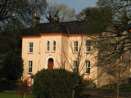 Gurteenroe HouseHouse · 970 yd
 CodrumCountry house · 1205 yd
_-_geograph.org.uk_-_6529588.jpg/250px-Castles_of_Munster,_Macroom,_Cork_(1)_-_geograph.org.uk_-_6529588.jpg "Photo: Garry Dickinson, Wikimedia Commons · CC BY-SA 2.0") Macroom CastleCastle · 1754 yd
Macroom CastleCastle · 1754 yd Macroom Castle (in Ruins)Castle, tower house · 1.0 mi
 Battle of MacroomBattle · 1.2 mi
 Sessile Oak1.4 mi
 The Gearagh Nature ReserveNature reserve · 1.9 mi
 Kilmurry WoodsPicnic place · 6.0 mi
 KnocknakillaArchaeological place · 7.0 mi
 Glantane EastArchaeological place · 7.1 mi
 Kilmichael Ambush SiteMonument · 7.2 mi
 CurracahillMountain / peak · 10 mi
More archaeology and monuments in County Cork · All of County Cork
What do you know about this place?