What is recorded here
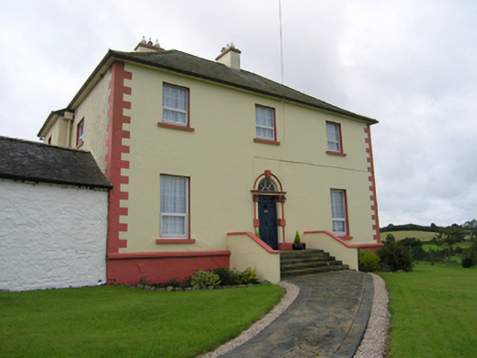
Detached L-plan three-bay two-storey former rectory, built 1788, now in use as private house. Hipped and sprocketed slate roof with clay ridge tiles, overhanging plainly treated eaves, central chimneystacks to main front and to ridge to side wing, both rendered painted with plain cornice, and replacement rainwater goods. Smooth rendered walls with quoins to front elevation, roughcast rendered walls to remaining elevations. Window openings with stone sills, replacement windows except for Wyatt window in north-west elevation having six-over-six timber sash windows with two-over-two side sashes. Round-headed door opening with Gibbsian surround and keystone with entablature salient below fanlight, having raised and fielded nine panelled timber door. Flight of five stone steps to threshold flanked by rendered walls. Two ranges of single-storey outbuildings enclosing elongated yard the south-east, closed at the south end by symmetrical two-storey stable block with hipped slated roof, rubble-stone walls with dressed stone quoins, brick dressings to windows and to central carriage arch, and stone sills.
A fine example of a late eighteenth-century glebe house with associated outbuildings, built at a cost of £649, and originally having 311 statute acres of glebe lands attached. Further improvements in the 1830s probably including the fine stable block to the south. The Gibbsian door surround, timber panelled door, and the surviving Wyatt window are important original details and materials. The outbuildings recall that eighteenth and nineteenth century rectors also farmed the glebe lands which provided a substantial part of the clergyman’s income. The house stands on high ground overlooking the drumlin landscape and can be seen from the main road to the east. Castleterra Glebe was the residence of the rector of Ballyhaise Church, a substantial church rebuilt in 1820.
From the Buildings of Ireland (National Inventory of Architectural Heritage) record 40402101
This does not grant access. Most recorded buildings are privately owned; view them only from public ground unless the owner allows entry.
Places near here
IndicatedFairy fort / earthen ringfort · 1117 yd St Patrick's Roman Catholic ChurchChurch/chapel · 1278 ydCorgarveMountain / peak · 1757 ydFin Mc Cools FingersStone row · 1.1 miSt Mary's Roman Catholic ChurchChurch/chapel · 1.2 miGarden IsleIslet · 1.3 miCastleCastle, unclassified · 1.4 miBallyhaise HouseCastle, unclassified · 1.4 miArdamaghMountain / peak · 2.0 miEuropean Beech2.3 miRambling at Farnham EstateVisitor information · 4.8 miPedunculate Oak5.3 mi
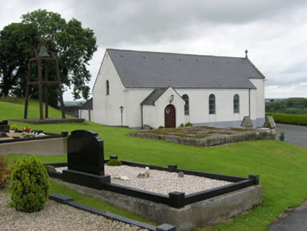 St Patrick's Roman Catholic ChurchChurch/chapel · 1278 ydCorgarveMountain / peak · 1757 yd
 Fin Mc Cools FingersStone row · 1.1 mi
 St Mary's Roman Catholic ChurchChurch/chapel · 1.2 miGarden IsleIslet · 1.3 miCastleCastle, unclassified · 1.4 miBallyhaise HouseCastle, unclassified · 1.4 miArdamaghMountain / peak · 2.0 mi
 European Beech2.3 mi
 Rambling at Farnham EstateVisitor information · 4.8 mi
 Pedunculate Oak5.3 mi
Pictures: National Inventory of Architectural Heritage; Deadstar, Wikimedia Commons · CC BY-SA 4.0; Deadstar ( msg ), Wikimedia Commons · CC BY-SA 3.0; Malene Thyssen, Wikimedia Commons · CC BY-SA 3.0; Peter Gerken, Geograph · CC BY-SA 2.0; Algirdas at Lithuanian Wikipedia, Wikimedia Commons · Public domain
More historic places in County Cavan · All of County Cavan
What do you know about this place?