What is recorded here
In farmyard, atop low rise. Rectangular area (47.1m E-W; 39.1m N-S), enclosed by high walls with circular flanking tower at each corner (int. diam. c. 4.6m; wall thickness c. 1.4m). Entire complex renovated in 18th/19th century and converted to a country house with ancillary buildings; now largely fallen to ruin though interior still used as farmyard. Entire structure shows signs of 18th/19th-century alteration: upper levels of curtain walls and towers have mock crenellated parapets supported on corbels; opposite each other, in centre of E and W curtain walls, are arched and crenellated gateways; all four towers have inserted windows, fireplaces and wooden floors (each now gutted). Ranges of 2-storey farm buildings stand against inside of N and S curtain walls, some still in use; central courtyard is cobbled, though some areas of interior have more recent concrete floors. All four towers have original walling to either 1st- or 2nd-floor level, but all have been built up to present parapet level above 2nd floor, except SW tower which had two further floors added and now stands to five floors. Both SW and NE towers have series of deeply splayed gun loops at ground-floor level; other two likely to have had same but alterations now conceal them. Each tower has inserted fireplaces and windows; many of latter have cut limestone surrounds of 18th/19th-century appearance, others have wooden lintels and frames; fireplace arches mostly of brick. No internal stairs survive; original floors probably wooden throughout, resting on five large joists, judging by blocked joist holes over ground floor in NE tower. Principal seat of the O'Keeffes (Ó Murchadha 1985, 43), and held by them until forfeited after 1642 rebellion (ibid., 44); according to Healy (1988, 331), built c. 1582. In mid-18th century (Smith 1750, vol. 1, 294) residence of a 'Mr. Philpot'; by early 19th century (Lewis 1837, vol. 1, 509) this was 'the property of Mr Leader, by whose father one of the towers has been raised and fitted up, and part of the enclosure fitted up as offices'; when Grove White (1905-25, vol. 3, 57; see photograph opp. 54) visited site in 1910 he noted 'a house on the N. side occupied by Mr. W. Leader's steward...the range on the south side are stables etc.' According to local information, house deliberately burnt in early 1920s.
In farmyard, atop low rise. Rectangular area (47.1m E-W; 39.1m N-S), enclosed by high walls with circular flanking tower at each corner (int. diam. c. 4.6m; wall thickness c. 1.4m). Entire complex renovated in 18th/19th century and converted to a country house with ancillary buildings; now largely fallen to ruin though interior still used as farmyard. Entire structure shows signs of 18th/19th-century alteration:…
From the National Monuments Service (Archaeological Survey of Ireland) record CO030-143
The monument record does not grant public access. Check the route and ask the landowner before entering private land.
- What survives
- Recorded monument
Places near here
Photo credits
- National Inventory of Architectural Heritage
- Maker shown on the Wikimedia Commons file page · CC BY-SA 3.0
- The Speckled Bird, Wikimedia Commons · CC BY-SA 4.0
- Jonathan Thacker, Geograph · Creative Commons Attribution-ShareAlike 2.0
- Jonathan Thacker, Geograph · CC BY-SA 2.0
- Mike Searle, Wikimedia Commons · CC BY-SA 2.0
IndicatedGraveyard · 408 yd church/chapel419 ydFr John Barry MemorialMonument · 1225 ydBattle of KnocknaclashyBattle · 1.7 miDrominagh Castle (Site of)Castle, unclassified · 1.9 miRathcool WoodWood · 2.8 miKanturk CastleHeritage attraction · 3.7 miHanna SheehyMemorial · 4.2 miGrave YardGraveyard · 4.8 miMount Hillary - Father Murphy LoopWalking route · 4.9 miCastle and TurretCastle, tower house · 4.9 miSt. Patrick's ChurchVisitor information · 6.3 mi
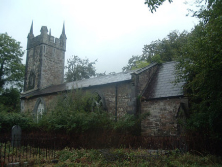 church/chapel419 yd
 Fr John Barry MemorialMonument · 1225 yd
 Battle of KnocknaclashyBattle · 1.7 miDrominagh Castle (Site of)Castle, unclassified · 1.9 miRathcool WoodWood · 2.8 mi
 Kanturk CastleHeritage attraction · 3.7 miHanna SheehyMemorial · 4.2 mi
 Grave YardGraveyard · 4.8 mi
 Mount Hillary - Father Murphy LoopWalking route · 4.9 mi
 Castle and TurretCastle, tower house · 4.9 mi
 St. Patrick's ChurchVisitor information · 6.3 mi
More castles and forts in County Cork · All of County Cork
What do you know about this place?