Places near here
Photo credits
- Olivier BEZES, Wikimedia Commons · CC BY 2.5
- MBE21, Geograph · CC BY-SA 2.0
- Sitomon, Wikimedia Commons · CC BY-SA 2.0
- Royalcanalrunner, Wikimedia Commons · CC BY-SA 4.0
- C O'Flanagan, Geograph · CC BY-SA 2.0
- DiggingSpace, Wikimedia Commons · CC BY-SA 4.0
- The British Library, Wikimedia Commons · No restrictions
- Harold Strong, Geograph · CC BY-SA 2.0
- jwd, Geograph · CC BY-SA 2.0
- Carroll Pierce, Wikimedia Commons · CC BY-SA 2.0
Explorer Tom Concentric enclosure in Salestown would survive a zombie attack by locking the wide entrance gap twice. It's an oval inside a bigger circle, like a Russian doll made of dirt. It's free, it's odd, what more do you want?
Ash HillMountain / peak · 1230 yd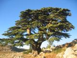 Lebanon Cedar1.3 mi
Explorer Tom Lebanon Cedar in Kildare would tell you it's a senior manager, but its résumé is mostly just standing still since Tuesday. It’s got that 'I survived the ice age' look down there. Perfect spot to practise your best tour-guide voice.
 CartonHouse, 17th century · 1.4 mi
Explorer Tom Carton is hiding a treasure chest that is definitely just a biscuit tin from 1974. The Earl probably used it to store his spare socks and lost his mind over it. Ideal stop for a big stretch and a bigger yawn.
 European Yew1.6 mi
 Pike BridgeBridge · 1.7 mi
Explorer Tom Pike Bridge claims it’s older than the railway line itself, which is a wild but unprovable boast for me. It spans both the canal and the tracks, making it a real multitasking legend. Pop by and tell it I said hello, loudly!
 Moygaddy Tower HouseRuins · 1.9 mi
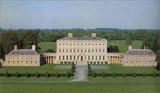 Castletown HouseHeritage attraction · 3.6 mi
 Luttrellstown CastleCastle · 4.7 mi
Explorer Tom Luttrellstown Castle in County Dublin has been featured in an 1898 book about picturesque Dublin, which makes it sound like a proper old postcard. The Brit Lib has the details, but we'll just enjoy the vibe instead.
 Church, GraveyardChurch · 4.8 mi
Explorer Tom Church in Clonsilla, County Dublin has had so many names it's getting confused. The land has history going back to 500AD, which is older than some of us are old. Bring your nan, she'll know more than me.
 Griffeen Valley WalkWalking route · 5.6 mi
Explorer Tom Griffeen Valley Walk in County Dublin has a river that merges into Vesey Park, which sounds like a fancy garden party gone wrong. Grab a photo of the water for me!
 Hermitage ParkPark · 5.9 mi
Explorer Tom Hermitage Park in County Dublin is where the locals go to be left alone, but they're not very good at it. No records? I bet there's a hermit who actually enjoys the company. Say hi!
More castles and forts in County Meath · All of County Meath

What do you know about this place?Tap to add a comment or ask a question