What is recorded here
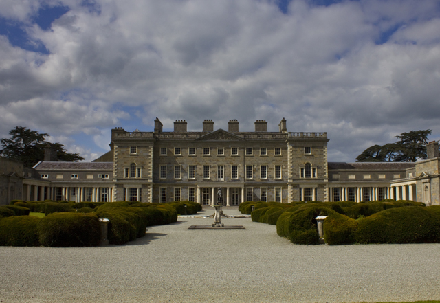
Carton wears a grand Palladian front while its old Dutch pediment hides behind. It’s the country-house version of buying a magnificent new suit and then turning round to reveal your old trousers tucked into the back.
The lands at Carton were owned by the Earls of Kildare and in the late-17th century were leased to the Talbot family who erected the first building, a Dutch-style house with a pedimented breakfront which is recorded in a painting by Van der Hagen (SMR file). Carton was subsequently forfeited to the Crown and sold in 1703 to Maj. Gen. Richard Ingolsby, Lord Justice of Ireland who added a two storey, nine bay pedimented front with wings joined to the main block by curved sweeps, in the Palladian manner. In 1739 the estate was sold back to the 19th Earl of Kildare who made Carton his principal seat, employing Richard Castle to enlarge the house, which work obliterated all trace of the older house except for a cornice on the entrance front and unusually thick internal walls. The house was again remodelled and enlarged c. 1815 by Sir Richard Morrison for the Kildares who had by the become the Dukes of Leinster. The great demesne, covering c. 1000 acres, was formally landscaped in the 18thC, with further improvements in the 19th century (Bence Jones 1978, 60; Horner 1975 - reference in 1976 Foras Forbartha report in SMR file).
The lands at Carton were owned by the Earls of Kildare and in the late-17th century were leased to the Talbot family who erected the first building, a Dutch-style house with a pedimented breakfront which is recorded in a painting by Van der Hagen (SMR file). Carton was subsequently forfeited to the Crown and sold in 1703 to Maj. Gen. Richard Ingolsby, Lord Justice of Ireland who added a two storey, nine bay…
From the National Monuments Service (Archaeological Survey of Ireland) record KD006-009
The monument record does not grant public access. Check the route and ask the landowner before entering private land.
- What survives
- Recorded monument
Places near here
Photo credits
- Olivier BEZES, Wikimedia Commons · CC BY 2.5
- C O'Flanagan, Geograph · CC BY-SA 2.0
- Sitomon, Wikimedia Commons · CC BY-SA 2.0
- Royalcanalrunner, Wikimedia Commons · CC BY-SA 4.0
- National Inventory of Architectural Heritage
- William Murphy from Dublin, Ireland, Wikimedia Commons · CC BY-SA 2.0
- Ilja Klutman from Ballinakill, Ireland, Wikimedia Commons · CC BY-SA 2.0
HermesMemorial · 53 ydSun clockMemorial · 73 yd Lebanon Cedar116 ydIndicatedHoly well · 725 ydMoygaddy CastleCastle, tower house · 1103 ydMoygaddy Tower HouseRuins · 1103 ydEuropean Yew1234 ydIndicatedHoly well · 1291 ydPike BridgeBridge · 1735 ydMariavilleHouse · 1.0 miMaynooth CastleHeritage attraction · 1.3 miConolly's FollyHeritage attraction · 1.5 mi
 Lebanon Cedar116 ydIndicatedHoly well · 725 ydMoygaddy CastleCastle, tower house · 1103 yd
 Moygaddy Tower HouseRuins · 1103 yd
 European Yew1234 ydIndicatedHoly well · 1291 yd
 Pike BridgeBridge · 1735 yd
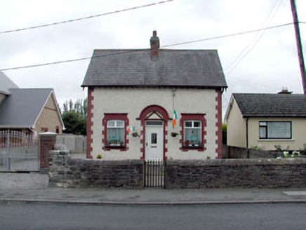 MariavilleHouse · 1.0 mi
 Maynooth CastleHeritage attraction · 1.3 mi
 Conolly's FollyHeritage attraction · 1.5 mi
More historic places in County Kildare · All of County Kildare
What do you know about this place?