What is recorded here
Situated on a gentle S/SW-facing slope, on the edge of the Blessington Reservoir which has encroached on the site from S-SE. Circular area (diam. 52m; max. ext. diam. 85m) defined by a bank (Wth 6m; int. H 1-1.5m), an external fosse (everywhere except at the S where it has been washed away) (Wth 9m; D 0.5-1.6m) and an outer counterscarp bank (Wth 9m; H 1-1.8m) from W-NNE. No indication of an entrance or internal features. Limited excavation revealed two hearths and a simple stone lined drainage gully (Macalister 1943, 147-9).
Situated on a gentle S/SW-facing slope, on the edge of the Blessington Reservoir which has encroached on the site from S-SE. Circular area (diam. 52m; max. ext. diam. 85m) defined by a bank (Wth 6m; int. H 1-1.5m), an external fosse (everywhere except at the S where it has been washed away) (Wth 9m; D 0.5-1.6m) and an outer counterscarp bank (Wth 9m; H 1-1.8m) from W-NNE. No indication of an entrance or internal…
From the National Monuments Service (Archaeological Survey of Ireland) record WI005-048
The monument record does not grant public access. Check the route and ask the landowner before entering private land.
- What survives
- Recorded monument
Places near here
Photo credits
- 瑞丽江的河水, Wikimedia Commons · CC BY-SA 4.0
- National Inventory of Architectural Heritage
- originally uploaded to the English Wikipedia by w:User:Jtdirl, Wikimedia Commons · Public domain
- Wanfried-Dublin, Wikimedia Commons · CC BY-SA 4.0
Castle (in ruins)Castle, tower house · 401 yd CrossCross, High cross (present location) · 779 ydBaltyboys HouseCountry house · 1204 ydCouncillor Jim MileyMemorial · 1647 ydProclamation of the Irish RepublicMemorial · 1687 ydSaint Joesph's HallChurch hall/parish hall · 1.0 miWedge tomb in CarrigWedge tomb · 1.3 miCastleCastle, unclassified · 1.4 miBlessington DemesneWood · 1.4 miArtisans WorkshopsHeritage attraction · 1.5 miNational Bird of Prey CentreHeritage attraction · 1.5 miDeer Park PlantationForest · 1.6 mi
 CrossCross, High cross (present location) · 779 yd
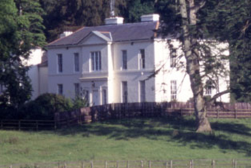 Baltyboys HouseCountry house · 1204 ydCouncillor Jim MileyMemorial · 1647 yd
 Proclamation of the Irish RepublicMemorial · 1687 yd
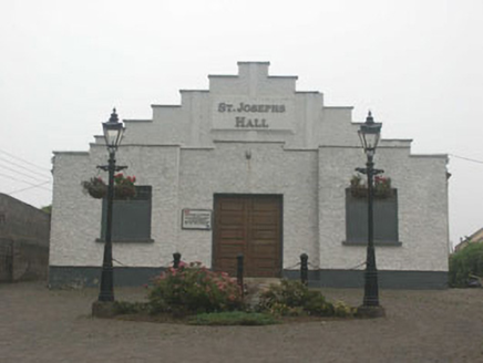 Saint Joesph's HallChurch hall/parish hall · 1.0 mi
.jpg/250px-CarrigWedgeTomb_(1).jpg "Photo: Wanfried-Dublin, Wikimedia Commons · CC BY-SA 4.0") Wedge tomb in CarrigWedge tomb · 1.3 miCastleCastle, unclassified · 1.4 miBlessington DemesneWood · 1.4 miArtisans WorkshopsHeritage attraction · 1.5 miNational Bird of Prey CentreHeritage attraction · 1.5 miDeer Park PlantationForest · 1.6 mi
Wedge tomb in CarrigWedge tomb · 1.3 miCastleCastle, unclassified · 1.4 miBlessington DemesneWood · 1.4 miArtisans WorkshopsHeritage attraction · 1.5 miNational Bird of Prey CentreHeritage attraction · 1.5 miDeer Park PlantationForest · 1.6 miMore castles and forts in County Wicklow · All of County Wicklow
What do you know about this place?