Places near here
Photo credits
- National Inventory of Architectural Heritage
- Willow, Wikimedia Commons · CC BY 2.5
- dougf, Wikimedia Commons · CC BY-SA 2.0
- Bob Embleton, Wikimedia Commons · CC BY-SA 2.0
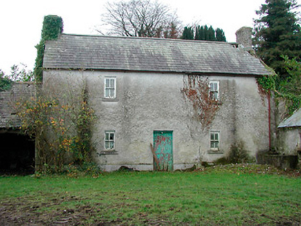 farm house655 yd
Explorer Tom Farm house in Cartron is standing straight as an arrow, looking like it has a twin hiding somewhere under the Atlantic Ocean. It’s been sitting there with its blank walls, waiting for someone to finally ask what the heck is behind that door. Wave at it and hope it doesn’t start telling you about its imaginary sibling.
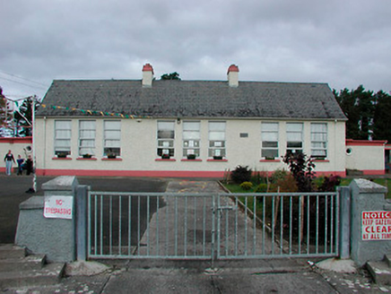 Kilcleagh National SchoolSchool · 1352 yd
Explorer Tom Kilcleagh National School is still arguing with the whole parish over who actually built it, and honestly, I’m not sure anyone remembers anymore. It’s got that water tower sticking up like a confused finger pointing at the clouds. Give it a wave from the road; it might just pretend to be taking its tea break.
CastleCastle, unclassified · 1662 ydExplorer Tom Castle in Bolinarra was the favorite spot for a fiddler who played all night long until the cows got annoyed and left. It’s perched on top of a ringwork with a view that makes you want to shout into the void for no reason at all. Perfect spot to practise your best tour-guide voice.
 European ash2.1 mi
Explorer Tom European ash in County Westmeath is standing tall after a local priest lost a bet about how many leaves it has and now refuses to speak to him. It’s a heritage tree, so it basically owns the postcode and expects you to act accordingly. Tell your mates you found it first.
 Esker CastleCastle, tower house · 3.3 miMoydrum Castle WoodlandForest · 3.5 mi
Explorer Tom Moydrum Castle Woodland has an imaginary twin across the sea that sends it postcards every year. It’s all very dramatic and full of unrequited love for distant shores. Stand still and listen, the wind tells it better than me.
Dún na SíMuseum · 3.6 miExplorer Tom Dún na Sí is hiding its fairy secrets behind museum curtains. Rumor has it the local goat refused to eat hay because it looked too much at the curator. Hum something sad nearby, it adds atmosphere.
Dún na Sí Heritage CentreMuseum · 3.6 miLong IslandIsland · 4.1 miExplorer Tom Long Island in County Roscommon got so long because the Vikings kept adding bits of land to it every time they got lost looking for it. It’s an island that thinks it’s a peninsula, but the water has other ideas about where it ends. Stand back, squint, and it looks like a castle.
Wren's IslandIslet · 4.8 miExplorer Tom Wren's Island would file a formal complaint with the council about how many people ignore it completely. It’s sitting in the lake looking small and ignored, probably dreaming of a bigger budget for grass. Go before the tourists find out.
 Rock art in ClonfinloughRock art · 6.6 mi
Explorer Tom Rock art in Clonfinlough claims to be older than your granddad’s bad haircut, and I believe it. It’s got holes from water and lines from fancy humans. Perfect spot to practise your best tour-guide voice.
More castles and forts in County Westmeath · All of County Westmeath

What do you know about this place?Tap to add a comment or ask a question