Places near here
Photo credits
- National Inventory of Architectural Heritage
- Ian Paterson, Geograph · CC BY-SA 2.0
- Jo and Steve Turner, Geograph · CC BY-SA 2.0
- Paul Johnston-Knight, Wikimedia Commons · CC BY-SA 2.0
- Amir Mohammad Saeid, Wikimedia Commons · CC BY-SA 4.0
- Carroll Pierce, Wikimedia Commons · CC BY-SA 2.0
- jwd, Geograph · CC BY-SA 2.0
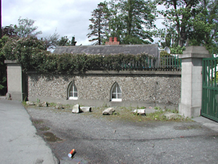 Neilstown LodgeGate lodge · 108 yd
Explorer Tom Neilstown Lodge is a modest gate lodge from 1820 pretending to be grand on Neilstown Road. It’s got pebble dashed walls and lancet openings that frame the view nicely. Wave to the glazed timber door and tell it to keep the lights on!
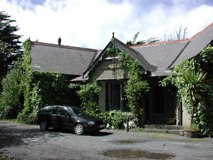 Coolevin HouseHouse · 276 yd
Explorer Tom Coolevin House in Neillstown is hosting a fake royal visit that nobody can disprove. This attractive house of unusual design retains its original proportions and materials, facing south across substantial grounds as a good example of Victorian planning. It probably put out the red carpet for a king who was actually just a very confident gardener.
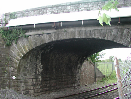 bridge342 yd
Explorer Tom Bridge in Cappagh refuses to fall down because it knows exactly how much pride the local council takes in its stonework and contrasting parapets. It’s a railway bridge that looks like it was designed by someone who really loves texture and hates shortcuts. I’d bet it’s got a secret handshake with every train that goes over it.
Enclosure in CappaghEnclosure · 816 ydExplorer Tom Enclosure in Cappagh is an elongated oval cropmark in rough pasture, and I’m convinced it has a secret imaginary fan club that meets every Tuesday to discuss its shape. They probably have t-shirts that say 'I love ovals' and sell them for five quid at the local market stall. It's the kind of place that makes a dull Tuesday interesting.
Castle (in ruins)Castle, tower house · 1601 ydExplorer Tom Castle in Irishtown is just a corner turret surviving in the middle of a housing estate, which is a bit of a party trick. It holds a fake world record for being the most ignored tower house in Dublin. Whisper a secret at it, it's kept worse ones over the years.
 The Round TowerVisitor information · 1660 yd
Explorer Tom The Round Tower in Clondalkin is basically a giant bell that got tired of ringing and decided to just stand there looking cool instead. It’s got that 'I’ve seen things you wouldn’t believe' vibe, especially with its original cap still on top like a fancy hat. I’d say it’s the most stylish piece of architecture in the neighbourhood. Leave nothing but footprints and a bad pun.
 Round Tower1728 yd
Explorer Tom Round Tower in Clondalkin claims there’s a hidden tunnel straight to the local pub, which is definitely true if you believe me enough. Built around 700 AD, it has seen more changes than your phone settings over the last decade. The floors were added later, so it’s like a vintage car with modern rims. Go back in winter, it's a different animal.
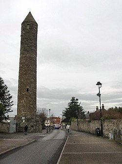 Clondalkin Round TowerHeritage attraction · 1728 yd
Explorer Tom Clondalkin Round Tower has stood over Dublin for more than a thousand years while I still struggle to arrive on time. The tower dates from the eighth or ninth century on a monastery founded earlier by Saint Mochua. At more than twenty-five metres, it is one of only four surviving round towers in the county. Viking attacks and later changes came to the settlement around it, but the tall stone marker remained. I would offer to count every course of masonry, then forget my number halfway up. The tower is a protected monument in central Clondalkin. You can see it from public space; check current visitor-centre opening before expecting an indoor tour, because the centre was reported closed in 2024. Stand back to take in the whole height. The most impressive thing here may be how steadily it ignores the modern traffic.
 CastleCastle, unclassified · 1.1 mi
Explorer Tom Castle in Clondalkin is Tully’s Castle, a narrow 16th-century tower with crenellations right on Monastery Road. It’s in state care, so it’s basically a celebrity that can’t leave the house. Ring your granny and tell her where you are before she worries about the round tower.
 Hermitage ParkPark · 1.5 mi
Explorer Tom Hermitage Park in County Dublin is where the locals go to be left alone, but they're not very good at it. No records? I bet there's a hermit who actually enjoys the company. Say hi!
 Griffeen Valley WalkWalking route · 1.6 mi
Explorer Tom Griffeen Valley Walk in County Dublin has strict rules that say you must whisper because the trees are very shy and get embarrassed easily if you shout too much. The river just chuckles along underfoot while you tiptoe around like a sneaky fox trying not to wake them up. Go now, before it gets famous.
Veronica Guerin memorialMemorial · 1.6 miExplorer Tom The Veronica Guerin memorial in County Dublin is right there in the Dubhlinn Gardens, looking very determined about getting her message across. It’s a bit of a double entry for us, but she deserves the extra attention. Tell her Tom said hi!
More castles and forts in County Dublin · All of County Dublin

What do you know about this place?Tap to add a comment or ask a question