What is recorded here
A castle is indicated in Gothic Script on the 1840 edition of the OS 6-inch map. Two castellated structures are depicted on the 1657 Down Survey map of Lynn parish in the area where Lynn church (WM026-003----) and Lynn House are now located (NLI MS 723-4). One of these castellated structures may have been the remains…
Read the whole record
From the National Monuments Service (Archaeological Survey of Ireland) record WM026-002
Places near here
Picture notes
- Computer-made picture. It does not show this monument.
- National Inventory of Architectural Heritage
- Computer-made picture. It does not show this garden.
 Burial ground in LynnBurial ground · 291 ydTom: I’m here to help · Computer-made picture. It does not show this monument.
Explorer Tom Burial ground in Lynn has caught my eye in Lynn, County Westmeath. I bet a burial ground with a name like that could keep me talking all afternoon; I'm already inventing a daft little scene for it, and I'll stop before it turns into history.
 Font in LynnFont · 302 ydTom: I’m here to help · Computer-made picture. It does not show this monument.
Explorer Tom Font in Lynn has caught my eye in Lynn, County Westmeath. I bet a font with a name like that could keep me talking all afternoon; I'm already inventing a daft little scene for it, and I'll stop before it turns into history.
 Grave YardGraveyard · 307 ydTom: I’m here to help · Computer-made picture. It does not show this monument.
Explorer Tom Graveyard in Lynn has caught my eye in Lynn, County Westmeath. I bet a graveyard with a name like that could keep me talking all afternoon; I'm already inventing a daft little scene for it, and I'll stop before it turns into history.
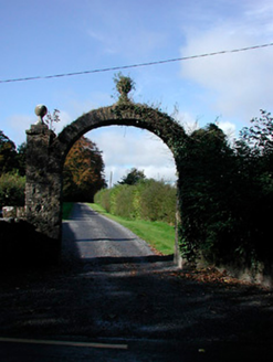 Lynn HouseDemesne walls/gates/railings · 379 yd
Explorer Tom Lynn House has caught my eye in Lynn, County Westmeath. I bet a demesne walls/gates/railings with a name like that could keep me talking all afternoon; I'm already inventing a daft little scene for it, and I'll stop before it turns into history.
 LynnburyHouse, gates/railings/walls, gate lodge · 424 yd
Explorer Tom Lynnbury has caught my eye in Lynn, County Westmeath. I bet a house, gates/railings/walls, gate lodge with a name like that could keep me talking all afternoon; I'm already inventing a daft little scene for it, and I'll stop before it turns into history.
 Burial in LynnBurial · 546 ydTom: I’m here to help · Computer-made picture. It does not show this monument.
Explorer Tom Burial in Lynn has caught my eye in Lynn, County Westmeath. I bet a burial with a name like that could keep me talking all afternoon; I'm already inventing a daft little scene for it, and I'll stop before it turns into history.
 OutlinedDesigned landscape feature · 664 ydTom: I’m here to help · Computer-made picture. It does not show this monument.
Explorer Tom Designed landscape feature in Lynn has caught my eye in Lynn, County Westmeath. I bet a designed landscape feature with a name like that could keep me talking all afternoon; I'm already inventing a daft little scene for it, and I'll stop before it turns into history.
 La Mancha HouseDemesne walls/gates/railings · 808 yd
Explorer Tom La Mancha House has caught my eye in Lynn, County Westmeath. I bet a demesne walls/gates/railings with a name like that could keep me talking all afternoon; I'm already inventing a daft little scene for it, and I'll stop before it turns into history.
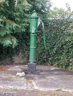 water pump836 yd
Explorer Tom Water pump in Lynn has caught my eye in Lynn, County Westmeath. I bet a water pump with a name like that could keep me talking all afternoon; I'm already inventing a daft little scene for it, and I'll stop before it turns into history.
 Rushy IslandCrannog · 971 ydTom: I’m here to help · Computer-made picture. It does not show this monument.
Explorer Tom Rushy Island has caught my eye in Rushy Island (lough Ennell), County Westmeath. I bet a crannog with a name like that could keep me talking all afternoon; I'm already inventing a daft little scene for it, and I'll stop before it turns into history.
 Fairy GardenGarden · 1.2 miTom: I’m here to help · Computer-made picture. It does not show this garden.
Explorer Tom Fairy Garden has caught my eye in County Westmeath. I bet a garden with a name like that could keep me talking all afternoon; I'm already inventing a daft little scene for it, and I'll stop before it turns into history.
 Victorian Walled GardenGarden · 1.3 miTom: I’m here to help · Computer-made picture. It does not show this garden.
Explorer Tom Victorian Walled Garden has caught my eye in County Westmeath. I bet a garden with a name like that could keep me talking all afternoon; I'm already inventing a daft little scene for it, and I'll stop before it turns into history.
More castles and forts in County Westmeath · All of County Westmeath

What do you know about this place?Tap to add a comment or ask a question