
What is recorded here
Castle Kerinstown and Balrowan stands as a grass-covered oblong mound on a gentle south-facing slope in County Westmeath, its rectangular shadow still visible in aerial photographs though external facing stones have vanished. One vertical lump of bonded masonry marks the southwest angle, rising two metres above the pasture where sheep likely grazed for centuries after the castle fell. The structure faced southeast, south and southwest, positioning watchers or residents to read weather, approach and movement across the ridge rather than hide from it. What is left is not a complete wall but a directional presence, a place where human attention once turned repeatedly toward the open land.
On a relatively gentle S-facing slope, just off the summit of a ridge, in pasture with extensive views to SE, S and SW. Depicted on the revised 1913 ed. OS 25-inch map as a long, rectangular-shaped structure, annotated ‘Castle (in ruins)’. Monument described in 1988 as a grass-covered oblong-shaped mound (dims. 15m N-S; 13m E-W) of earth and masonry with irregular edges (1.6m H at S; 40cm H at N; 1m H at E-W). There are no exposed cut or dressed stones or any other type of architectural fragments visible. There is a vertical lump of in-situ mortar bonded masonry (1.8m N-S; 1.4m E-W) representing the SW angle of the castle (ext. H 2.2m; int. H 1.5m). Apart from two foundation stones on the W side, all of the external facing stones are missing. There are no other features evident. Oblique aerial photograph (CUCAP BDK018) taken 14/07/1970 shows the masonry remains standing in corner of large rectangular enclosure which probably represents the remains of a bawn (WM020-117001-). Monument is visible as a subcircular-shaped stony mound on Digital Globe aerial photography.
Compiled by Alison McQueen, Vera Rahilly and Caimin O’Brien.
Date of upload: 08 July 2019
The monument record does not grant public access. Check the route and ask the landowner before entering private land.
- What survives
- Recorded monument
Places near here
 Bawn in Kerinstown and Balrowan (rowley)Bawn · 54 yd
 TobermíonadHoly well · 1075 yd
 OutlinedFairy fort / earthen ringfort · 1108 yd
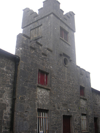 Lisnabin Castlestables, outbuilding · 1719 yd
 RoadRoad, hollow-way · 1740 yd
 Rathwire Moat & CastleCastle, motte and bailey · 1.2 mi
 GinkgoGinkgo · 4.3 mi
 ScregganWood · 6.4 mi
 Croppies' GraveMemorial · 8.8 mi
 Site of ChurchChurch · 1153 yd
 Enclosure in Porterstown (napper)Enclosure · 1262 yd
 EnclosureEnclosure, large enclosure · 1.0 mi
Other information
Photo: Credit not shown in the picture search · Rights wording not checked; contact us if this picture should be removed