What is recorded here
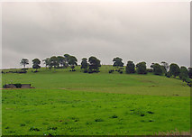
Kilcullane Castle described in 1840 as following; 'On the bank of the river (Camoge) east of the old Church (LI032-076001-) and in the same townland, remains the first arch of an old Castle, but the external face of the walls is destroyed. This building measures twenty one feet eight inches [6.6m] by thirteen feet ten inches [4.2mm] and the walls were five and a half feet [1.6m] in thickness (OSL, 44). Westropp (1906-7, 185-6) recorded the following details about Kilcullane Castle; '1244 Adam de Anno held Kilcallan at rent of a soar hawk and ½ mark of silver. Godfrey de Anno was heir (C.S.P.L). 1287 J. Daundon held it from Sir T. de Clare, as of Any manor, at rent of one pair of furred gloves and six pence (1b.). Ralph Brun, of.Kilkelen, fined (1b., 155). The Browne family appear to have held it thenceforward. 1583 T. Browne held Kylkyllane C[astle]. and Camas (Des. R., 67b; Peyton, p. 13; Inq. Exch., 11). 1607 Grant of these to Walter and E. Browne (Pat. R.). 1610 Edm. Baggott and D. O'Grady were granted Kilkillane. 1655 The decayed C[astle]. held by Teige O'Grady (C.S., xxxi., p. 22 ; D.S.A., 38)'. Kilcullane church (LI032-176001-) and castle depicted standing beside each other on the 1654-7 Down Survey map of Kilcullane Parish (NLI, MS 718). The 1654-56 Civil Survey of Limerick recorded that on the lands of Teige Grady of Kilcullane, there was a 'decayed Castle & 14 Cabins' (Simington 1938, 109).
Kilcullane Castle described in 1840 as following; 'On the bank of the river (Camoge) east of the old Church (LI032-076001-) and in the same townland, remains the first arch of an old Castle, but the external face of the walls is destroyed. This building measures twenty one feet eight inches [6.6m] by thirteen feet ten inches [4.2mm] and the walls were five and a half feet [1.6m] in thickness (OSL, 44). Westropp…
From the National Monuments Service (Archaeological Survey of Ireland) record LI032-077
The monument record does not grant public access. Check the route and ask the landowner before entering private land.
- What survives
- Recorded monument
Places near here
Photo credits
- National Inventory of Architectural Heritage
- Algirdas at Lithuanian Wikipedia, Wikimedia Commons · Public domain
- Martin Richard Phelan, Geograph · CC BY-SA 2.0
- deiseal, Wikimedia Commons · CC BY-SA 2.0
- Oliver Dixon, Geograph · CC BY-SA 2.0
- Dylan Moore, Geograph · CC BY-SA 2.0
Burial GroundGraveyard · 138 ydBawn in Ballinscoola (smallcounty By., Cahercorney Ed)Bawn · 873 yd Knockbologue HouseHouse · 1546 ydCloughansoun BridgeBridge · 1695 ydCastle (in ruins)Castle, unclassified · 1.4 miGlen BogForest · 1.5 miPedunculate Oak1.8 miLough Gur Heritage CentreVisitor information · 1.8 miBolin IslandCrannog · 1.8 miThe SpectaclesVisitor information · 1.9 miKnockainyMountain / peak · 2.1 miFlat cemetery in Knockainy WestFlat cemetery · 2.8 mi
 Knockbologue HouseHouse · 1546 yd
 Cloughansoun BridgeBridge · 1695 ydCastle (in ruins)Castle, unclassified · 1.4 miGlen BogForest · 1.5 mi
 Pedunculate Oak1.8 mi
 Lough Gur Heritage CentreVisitor information · 1.8 mi
 Bolin IslandCrannog · 1.8 mi
 The SpectaclesVisitor information · 1.9 mi
 KnockainyMountain / peak · 2.1 miFlat cemetery in Knockainy WestFlat cemetery · 2.8 mi
More castles and forts in County Limerick · All of County Limerick
What do you know about this place?