What is recorded here
Kilcullane church ruins (LI032-076001-) stands on N side of graveyard with Kilcullane Castle (LI033-077----) and River Camoge 110m to E. Church ruins and graveyard described in 1840 as following; ‘The old Church of this Parish is situated in a small graveyard not much used and on level ground in the Town land of Kilkillaun, about three hundred yards west of the River Camog’ (OSL, 44). Graveyard consists of a roughly rectangular shaped area (approx. dims. 15m N-S x 24m E-W) enclosed by post-1700 stone wall with nave and chancel church forming N boundary of graveyard.
Kilcullane church ruins (LI032-076001-) stands on N side of graveyard with Kilcullane Castle (LI033-077----) and River Camoge 110m to E. Church ruins and graveyard described in 1840 as following; ‘The old Church of this Parish is situated in a small graveyard not much used and on level ground in the Town land of Kilkillaun, about three hundred yards west of the River Camog’ (OSL, 44). Graveyard consists of a…
From the National Monuments Service (Archaeological Survey of Ireland) record LI032-076002
The monument record does not grant public access. Check the route and ask the landowner before entering private land.
- What survives
- Recorded monument
Places near here
Photo credits
- National Inventory of Architectural Heritage
- Algirdas at Lithuanian Wikipedia, Wikimedia Commons · Public domain
- Martin Richard Phelan, Geograph · CC BY-SA 2.0
- deiseal, Wikimedia Commons · CC BY-SA 2.0
- Oliver Dixon, Geograph · CC BY-SA 2.0
- Ballyhoura Failte, Wikimedia Commons · CC BY-SA 2.0
- Dylan Moore, Geograph · CC BY-SA 2.0
Castle (in ruins)Castle, unclassified · 138 ydBawn in Ballinscoola (smallcounty By., Cahercorney Ed)Bawn · 867 yd Knockbologue HouseHouse · 1473 ydSaint Patrick's Catholic ChurchChurch/chapel · 1596 ydGlen BogForest · 1.4 miPedunculate Oak1.7 miLough Gur Heritage CentreVisitor information · 1.8 miBolin IslandCrannog · 1.8 miThe SpectaclesVisitor information · 1.8 miGiants GraveMegalithic tomb · 1.9 miKnockainyMountain / peak · 2.1 miFlat cemetery in Knockainy WestFlat cemetery · 2.8 mi
 Knockbologue HouseHouse · 1473 yd
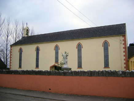 Saint Patrick's Catholic ChurchChurch/chapel · 1596 ydGlen BogForest · 1.4 mi
 Pedunculate Oak1.7 mi
 Lough Gur Heritage CentreVisitor information · 1.8 mi
 Bolin IslandCrannog · 1.8 mi
 The SpectaclesVisitor information · 1.8 mi
 Giants GraveMegalithic tomb · 1.9 mi
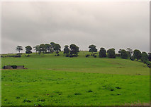 KnockainyMountain / peak · 2.1 miFlat cemetery in Knockainy WestFlat cemetery · 2.8 mi
More archaeology and monuments in County Limerick · All of County Limerick
What do you know about this place?