What is recorded here
Situated on the SE side of a farmyard associated with Culleenmore House. Depicted on the 1837 ed. OS 6-inch map as a rectangular-shaped structure adjoining a barn to NW. Depicted on the revised 1913 ed. OS 25-inch map as a rectangular-shaped structure annotated ‘Castle (in Ruins)’. The castle is depicted as a tower house type structure standing in S quadrant of townland on the N bank of a stream on the 17th century Down Survey map of Mullingar parish (NLI, MS 723-4). The terrier of the parish map lists William Pettit and Andrew Tuite as the owners of the lands of Cullanmore [Culleen More] in 1641, where they are described as 'Irish Papists' (ibid.). Monument described as the ruins of a rectangular-shaped tower house (ext. dims. 9.8m NW-SE; 7.8m NE-SW; wall T 1.5m) with barrel vaulted ground floor built with rubble stone walls (approx. H 5m) of which the NE and SE are best preserved. The NW corner has collapsed and the NW wall has been incorporated into a post-1700 stone barn running NW-SE off the NW wall of the tower house as depicted on the OS 25-inch map. The SE half of the ground floor barrel-vault is still intact. In the SE wall of the ground floor there is a large fireplace with a wall oven on the NE side. A possible bawn wall (WM019-009001-) runs SW off S angle and forms a rectangular-shaped enclosure to SW of the tower house. Near the E end of this wall there is a small pointed doorway of 15th/16th century date. There are earthworks (WM019-009002-) visible in the field to NE and SE. This monument is subject to a preservation order made under the National Monuments Acts 1930 to 2014 (PO no. 13/1987). See attached sketch plan showing layout of buildings and earthworks in farmyard of Culleenmore House
Compiled by: Alison McQueen, Vera Rahilly and Caimin O’Brien
Date of upload: 18 February 2019
Situated on the SE side of a farmyard associated with Culleenmore House. Depicted on the 1837 ed. OS 6-inch map as a rectangular-shaped structure adjoining a barn to NW. Depicted on the revised 1913 ed. OS 25-inch map as a rectangular-shaped structure annotated ‘Castle (in Ruins)’. The castle is depicted as a tower house type structure standing in S quadrant of townland on the N bank of a stream on the 17th…
From the National Monuments Service (Archaeological Survey of Ireland) record WM019-009
The monument record does not grant public access. Check the route and ask the landowner before entering private land.
- What survives
- Recorded monument
Places near here
Photo credits
- National Inventory of Architectural Heritage
- Bridget Neville, Wikimedia Commons · CC BY-SA 4.0
- kevin higgins, Geograph · CC BY-SA 2.0
- Copper1993, Wikimedia Commons · CC BY-SA 4.0
- Brian Shaw, Geograph · CC BY-SA 2.0
- Aerobug/Grace, Wikimedia Commons · CC BY-SA 4.0
- fr:Gavigan:Knockdrin_a.jpg/Knockdrin_a.jpg, Wikimedia Commons · GFDL
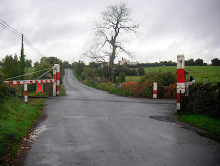 level crossing242 yd
 Saint Brigid's WellSpring · 322 ydEcclesiastical enclosure in Culleen MoreEcclesiastical enclosure · 372 yd
 Levington ParkGate lodge · 582 ydLady's IslandWood · 1617 ydCastlemitchelCastle, unclassified · 1641 yd
 Church IslandIsland · 1.4 miSrudarra IslandIslet · 1.5 mi
 Courthouse in MullingarCourthouse · 1.9 mi
 Famine MemorialMemorial · 1.9 mi
 Augustinian Monks Memorial StatueMemorial · 1.9 mi
 Knockdrin CastleCastle · 2.3 mi
More castles and forts in County Westmeath · All of County Westmeath
What do you know about this place?