
What is recorded here
Castlemitchel stands in Westmeath pasture as a broad earthen ring where a tower house once rose, losing its stones but keeping its shape beneath grass and memory. Thomas Petit held the land in 1641, marked in the survey as an Irish papist, while later maps showed buildings inside the bank before they vanished from the ground. The lane still cuts across the enclosure, and low wall footings in the northeast quadrant hint that the castle did not disappear so much as sink back into the earth.
Situated in pasture, 2.3km NW of Mullingar town. A tower house type fortification is depicted standing in the townland of Irishtown on the Down Survey map of Mullingar Parish (NLI, MS. 723-4). In 1641 the lands of Irishtown were in the possession of Thomas Petit who is described in the terrier of the Down Survey of Mullingar parish as an 'Irish papist' (ibid). Depicted on the 1837 ed. OS 6-inch map as a series of small fields and plots, some containing buildings with a laneway running ENE-WSW through the centre, the buildings are annotated ‘Castlemitchel’. Depicted on the revised 1913 ed. OS 25-inch map as a substantial roughly square-shaped earthwork which probably represents the bawn of the castle defined by an earthen bank with two rectangular buildings roughly aligned N-S standing in the centre that are annotated 'Castlemitchel'. A laneway running roughly E-W bisects the large square-shaped earthwork and provides access from the buildings to the public road which intersects the earthwork at W. Today there are no surface remains visible of the two buildings depicted on the OS 6-inch map.
Monument described in 1983 as the remains of a large subrectangular-shaped area (dims. 140m ENE-WSW; 135m NNW-SSE) enclosed by the remains of an earthen bank, an intervening fosse and an outer bank. The wide inner bank (Wth 4-8m; H c. 1m) is quite low and is particularly poorly preserved from SW-W and is irregular from W-NW. A shallow fosse is visible from WNW-N-E and a very wide fosse is evident from ESE-S-W. There is a causeway across the fosse at the SW corner, however this may not be an original feature. An outer bank (Wth 4-6m; H 1.5m-2m) is visible from ESE-S-SSW and is not seen elsewhere. A modern farm shed has been built on the line of the bank at ENE. The interior has a very slight and uneven NW-facing slope. The stony foundation of the laneway running ENE-WSW which bisects the site on the 1837 ed. OS 6-inch map can be traced on the ground surface. The enclosing element of the castle survives today as an upstanding earthwork visible from WNW-N-E-S-SSW, elsewhere is has been reduced to a low scarp. The enclosing elements of the castle are best preserved from E-S where it is visible as a bivallate tree-lined earthwork with intervening fosse. The low wall footings of a possible building probably the castle building itself can be seen in the NE quadrant of the enclosure. Castlemitchel was placed on the Register of Historic Monuments on the 25/04/1989.
Compiled by: Alison McQueen, Vera Rahilly and Caimin O’Brien
Date of upload: 03 April 2019
The monument record does not grant public access. Check the route and ask the landowner before entering private land.
- What survives
- Recorded monument
Places near here
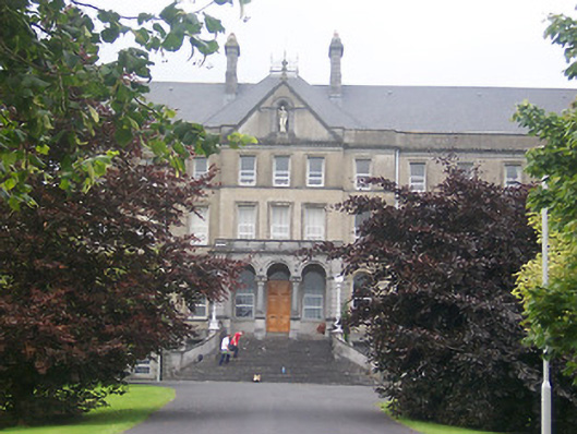 Saint Finian's Collegebuilding misc · 830 yd
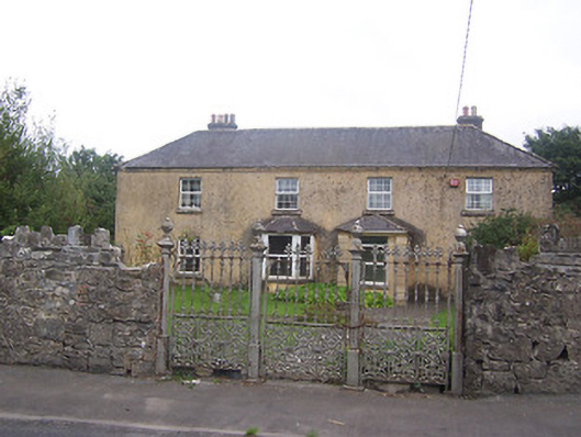 Ballyglassgates/railings/walls · 982 yd
 United Nations War MemorialMemorial · 1184 yd
 OutlinedFairy fort / earthen ringfort · 1193 yd
 Partially hachuredFairy fort / earthen ringfort · 1412 yd
 Saint Brigid's WellSpring · 1570 yd
 Castle (in Ruins)Castle, tower house · 1641 yd
 TullaghanCastle, tower house · 1685 yd
 Mullingar Cathedral MuseumMuseum · 1.2 mi
 Famine MemorialMemorial · 1.4 mi
 Lady's IslandWood · 1.4 mi
 The Chimera GalleryGallery · 1.4 mi
Other information
Photo: Credit not shown in the picture search · Rights wording not checked; contact us if this picture should be removed