
What is recorded here
Ordnance Survey first marked the castle in ruins in 1840, but nothing visible remains on the steep hill above Lough Derg today. In 1640 it stood on the lands of Donogh O'Bryen, and the 1654-56 Civil Survey described a barbican, slate house, garden, orchard, watermill and eight thatched tenements beside the Shannon. A court baron also belonged to the lands of Castletown, giving the place more than a fortress: it had law, labour and domestic life.
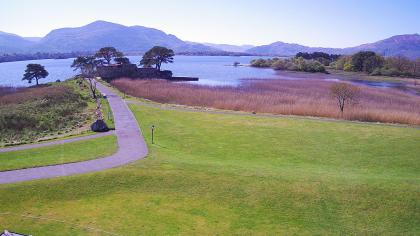
Situated on the lower N face of a steep hill with extensive views of Lough Derg. Depicted as a castle in ruins on the 1st ed. (1840) OS 6-inch map. No visible remains at ground level. In 1640 the castle of Castletown stood 'upon the sd. lands of Donogh O'Bryen' (Simington 1934, vol. 2, 153). The 1654-56 Civil Survey recorded that in this townland stood the ‘Castle of Castletowne (TN019-004----) sctiated close by the Shannon together with a barbicon & a Slate house (TN019-001001-) as alsoe a Garden & an Orchard a watermill (TN019-003----) and eight thatch tennem[en]ts, there also standeth the Parish Church of Castletowne (TN019-002001-)’ (Simington 1934 vol. 2, 153). This castle is depicted on the 1654-56 map of the Parish of Castletowne. The 1654-56 Civil Survey recorded that there 'alsoe belonged a Courte Barron to the sd. lands of Castletowne to be held at Castletowne by lettrs. Pattents' (Simington 1934, vol. 2, 153). It is unclear whether this castle is the tower house like castle depicted on the 1654-7 Down Survey map of Castletown parish (NLI, Ms. 721)
The above description is derived from 'The Archaeological Inventory of County Tipperary. Vol. 1 - North Tipperary' compiled by Jean Farrelly and Caimin O'Brien (Dublin: Stationery Office, 2002). In certain instances the entries have been revised and updated in the light of recent research.
Compiled by: Caimin O'Brien
Date of upload/revision: 5 February 2013
The monument record does not grant public access. Check the route and ask the landowner before entering private land.
- What survives
- Recorded monument
Places near here
 Old MillWater mill, unclassified · 199 yd
 Church (in Ruins), Grave Yd.Church · 264 yd
 IndicatedCastle, unclassified · 375 yd
 Enclosure in Ballywilliam (castletownarra Par.)Enclosure · 1298 yd
 Castle (in ruins)Castle, tower house · 1756 yd
 Millenium CrossHeritage attraction · 1.2 mi
 Patricks WellHoly well · 1.2 mi
 Scilly IslandIslet · 1.2 mi
 Laghtea HillMountain / peak · 1.2 mi
 Saint Patrick's RockNamed rock · 1.3 mi
 Crow IslandIslet · 1.4 mi
 Aughinish WoodForest · 1.7 mi
Other information
Photo: Credit not shown in the picture search · Rights wording not checked; contact us if this picture should be removed