National monument No. 201. Askeaton is located on the river Deel in west Limerick just inland from the Shannon estuary on the Limerick to Foynes road. According to Westropp (1903-4, 26-7) the placename is likely to derive from Eas Gephtine, Gephten’s
Cascade, a waterfall on the River Deel. The natural advantages…
Read the whole record
National monument No. 201. Askeaton is located on the river Deel in west Limerick just inland from the Shannon estuary on the Limerick to Foynes road. According to Westropp (1903-4, 26-7) the placename is likely to derive from Eas Gephtine, Gephten’s
Cascade, a waterfall on the River Deel. The natural advantages offered by the site occupied by
Askeaton Castle, an easily defensible island, would suggest that this should have been a settlement site from early times. In 1199 the site was fortified by the Anglo-Normans under William de Burgo and the Annals of Inisfallen record the building of a castle there. Incidental
references in the thirteenth and fourteenth centuries indicate that Askeaton was a sizeable Anglo-Norman settlement (Westropp 1903-4, 30-1) and as the "town of Inskefty" contributed 40s to the military subsidy of 1300 in aid of Edward II’s wars in Scotland (Mills 1905, 304). This
reference suggests that it was an incorporated settlement by this time. It was only in the middle of the fourteenth century that Askeaton became part of the Desmond lands and they were to
hold it as one of their principal residences for two centuries. It was the strategic importance of the castle which signalled out Askeaton for special attention during the Elizabethan conquest of Munster. As early as 1569 it had been selected as the residence of the President of Munster. In
1579 and English army under Sir Nicholas Malbie sacked Askeaton and burned the Franciscan Friary but failed to capture the castle. In the following year, however, the castle was captured by Pelham the lord justice. It was not until the early years of the seventeenth century, however,
that new settlers began to establish themselves at Askeaton. In 1610 Sir Francis Berkeley offered to wall Askeaton and he was subsequently granted the castle and forty acres of
land (Westropp 1903-4, 164). In 1613 the settlement was incorporated and its charter stated that it was to have a corporation consisting of a sovereign and twelve free burgesses. It continued to return two members of parliament until the Union of 1800. Despite this parliamentary status the settlement did not expand and it was to remain a small
market town throughout the seventeenth century. It generally appears in records only because of the importance of the castle. Once the castle itself was slighted by Axtell in 1652 and subsequently abandoned the references become even more scarce (Westropp 1903-4, 170-4). Castle fabric described in the Urban Survey of County Limerick (Bradley et. al. 1989, 58-74) as following: 'The castle occupies a lozenge shaped island, c. 142m N-S and c. 82m E-W in the river Deel, immediately south of the bridge in the centre of Askeaton and in the townland of Aghalacka. It consists of an outer ward, roughly following the outline of the island, with a centrally positioned inner ward on a limestone outcrop of rock of ovoid plan. On the west perimeter of the outer ward is a fine rectangular hall, originally of 13th century date but heavily altered in the fifteenth century. The inner ward is dominated by the remains of a large sixteenth century house at its north end, while at the south end are the remains of a rectangular tower of thirteenth century date (as are the surviving curtain walls), also modified in the fifteenth century. The masonry is of limestone throughout, and for the most part is roughly coursed rubble. THE OUTER WARD
The castle is entered from the bridge by means of a causeway running south from the centre of the bridge, across the river with a large, modern round headed gateway at the south end. This and the house on the west side of the causeway occupy the site of the original gatehouse, which according to the 'Pacata Hibernia' drawing consisted of a large round headed gateway in the curtain wall, with a barbican-like projection on the causeway to the north, fronted by another large round-headed gateway on the bridge. The only surviving stretch of curtain wall is on the north-west between the entrance causeway and the hall. Elsewhere, modern walls around the perimeter of the island probably follow the line of the curtain walls, but some uncertainty remains regarding the south boundary. A modern east/west wall cuts off a triangular area at the south end of the island, which presumably is the castle garden, noted in a 1583 inquisition and apparently enclosed (Westropp 1903-4, 118-9). Thus it is not clear whether the east/west wall reflects the south boundary of the outer ward, or whether this included the whole island. The outer curtain, where it survives on the north west is of fifteenth or sixteenth century date, as indicated by the presence of gun loops and by its being built onto the north/west corner of the remodelled fifteenth century hall. The wall is up to 5m high internally, with a wall-walk at 3m. Beneath wall-walk level are seven large splayed segmental arched embrasures containing small rectangular 'gun-loops, some with round enlargements at the base. About 20m west of the entrance causeway was a projecting bastion in the wall clearly shown on the 'Pacata Hibernia' drawing; only traces of it survive, and the opening is filled with modern masonry. The parapet of the wall-walk changes at this point; west of the bastion is a crenallated parapet, with splayed gun-loops of various forms in the merlons but east of the bastion is an unbroken parapet with small splayed gun-loops, the outer openings c. 10m square, presumably a later rebuilding. The Hall
On the west perimeter of the outer ward is a rectangular, gabled hall of two floors, measuring c. 32m north/south by c. 14m east/west, with a slightly wider (c. 15.5m) section at the south and a projecting square stair turret on the west. The walls are intact, the north and south gables being c. 14.5m high and the east and west walls c. 10m high. The hall consists of a core, probably of c. 13th century date, which was heavily altered in the fifteenth century. The two phases are distinguishable by their masonry, that of the thirteenth century phase being roughly coursed rubble while that of the fifteenth century is dressed ashlar. The first floor level of the rebuilt hall is also somewhat higher than that of the original hall due to the insertion of vaulting over the ground floor while the line of the original gable, c. 4-5m lower than the present gable, is visible in the south wall of the first floor hall. The thirteenth century hall was of two floors, and appears to have consisted at ground floor level, of a central chamber c. 18m north/south by c. 13m east/west externally, with broader (c. 15.5m east/west) sections which project on the east, to the north and south. The central chamber was lit by four pairs of large windows, set opposite each other at intervals of c. 2.5m in the east and west walls; these had flat rear arches and window seats which survive, but the windows themselves were removed in the fifteenth century alterations. In the alterations the external east, west and north walls were refaced with coursed ashlar masonry, and a basal batter, 3.25m high and 60cm wide was added above a plinth 5Ocm high and 12cm wider than the batter. With the exception of the north pair, the windows of the central chamber were replaced by tall rectangular loops with splaying jambs set into the batter; the north pair were replaced by a large rectangular opening, in the east wall and a tall pointed doorway leading to the stair turret in the west wall. The north and south walls of the central chamber were largely refaced, due to the insertion of vaulting in the fifteenth century; the only possible original features visible are a pointed opening, lacking its rear arch at the west end of the south wall and a segmental doorway in the north wall. In the fifteenth century alterations, the central chamber was divided by a wall running between, and partly blocking, the second pair of windows from the south. In the chamber formed to the south of this wall, a poi

 Askeaton CastleHeritage attraction · 13 yd
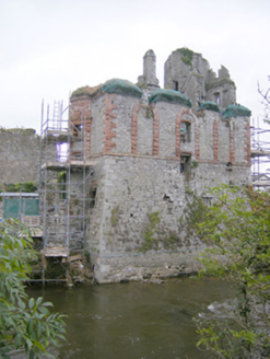 The Hellfire ClubHouse · 22 yd
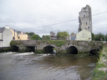 bridge61 yd
 Bridge in Aghalacka,askeaton,cloonreaskBridge · 61 yd
 Bridge HouseHouse · 78 yd
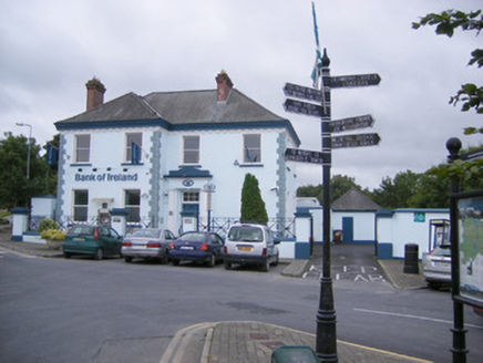 Bank of IrelandBank/financial institution · 81 yd
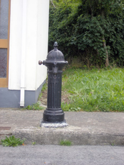 water pump138 yd
 kiln138 yd
 store/warehouse164 yd
 Askeaton GAA pitchGAA ground · 471 yd
 Memorial stone in Moig SouthMemorial stone · 489 yd
 Fairy fort / earthen ringfort in CloonreaskFairy fort / earthen ringfort · 828 yd

What do you know about this place?Tap to add a comment or ask a question