The passage tomb cemetery often referred to as Loughcrew is dispersed between three of the summits of the ENE-WSW Slieve na Calliagh ridge. It escaped attention during the making of the 1836 edition of the OS 6-inch map, and almost the first notice occurs in 1864 when E. A. Conwell published an account of the cairns in the Proceedings of the Royal Irish Academy and in subsequent papers (1866, 1873, 1879). From the west the principal hilltops are known as Carnbane West, Carnbane East, also called Slieve na Calliagh, and Patrickstown. In the folk tradition as recorded by John O’ Donovan in the 1830s (Herity 2001, 38) the cairns were created when a witch, the Calliagh Bhéarra (Beara peninsula, Co. Cork) was performing a magic ritual by jumping eastwards from hilltop to hilltop, depositing stones from her apron. The leap from Patrickstown was too strenuous and she slipped and died on the hillside. She is reputed to be buried on the S side of that hill. Conwell had been digging the cairns since 1863 with the support of J. L. W. Napper, a local landowner and savant who owned most of the land at Carnbane East and West, while Patrickstown was owned by E. Crofton Rotheram, also an antiquary. Conwell’s descriptions are invaluable and are still used, while his scheme for identifying the tombs by letter, sometimes with additional numbers, is still adhered to today. Apart from an article published in Scotland (Frazer 1892-3) with drawings by du Noyer, and inclusion in Borlase’s work on the dolmens of Ireland (1897) little attention seems to have been paid to the discoveries at the time. There were smaller excavations by Coffey (1897) and Rotheram (1895, 1897), and Morris (1930), misled by Conwell’s belief that the cemeteries might be part of the location of the great fair of Tailtean, speculated further along those lines. These various investigations have revealed the internal structures and the art of many of the tombs, and most of the artefacts recovered during them are now in the National Museum of Ireland. Since the late nineteenth century there was little further notice of the cairns, apart from an investigation and restoration of Cairn H in 1943 by Joseph Raftery of the National Museum of Ireland and passing references in general prehistories, until Professor Herity’s work on Irish Passage Tombs (1974). This drew together the results of all the previous work, catalogued the artefacts recovered, and highlighted the tombs and the great wealth of prehistoric art they contain. Since then they have hardly been out of the public eye, with academic studies (McMann 1991; Shee Twohig 1981) as well as popular guides (McMann 1993). Herity’s survey and Shee Twohig’s work on the art are the most comprehensive to date, and their records form the core of these descriptions. More recently attention has switched to theorising about the development of the tombs and the cemeteries (Sheridan 1985/6; Cooney 2000, 158-63), researching the solar events that can be observed at cairns on Patrickstown Hill (O’Sullivan et al. 2010) and Carnbane East (McCormick 2012), and recording the rock art that can be found on the lower slopes of the hills (Shee Twohig et al. 2010). The cairns are distributed between the hilltops of Carnbane West in Loughcrew and Newtown townlands (14) together with at least three standing stones, on Carnbane East in Corstown townlnad (7) with a standing stone, and at Patrickstown (4). There are other cairns (6), a ring-barrow, and standing stones in the col between the first two hills. Today only the monuments at Carnbane East and Patricktown, which are all National Monuments, can be visited. In his first communication Conwell (1864, 47-8) stated that 21 cairns in Thomastown townland on the S side of Patrickstown Hill, of which (
ME015-111----) is probably the last survivor, were being removed at that very time. This is located at the crest of the S-facing summit of Carnbane West and c. 50m SW of Cairn D (
ME015-003008-). It has been designated A3 by Conwell (1866, 360; 1873, 49) and it consists of a large circular and grass-covered cairn (diam. of base 33.5m E-W; 33.6m N-S; H 2.5m at N to 3.5m generally) which has had an old grass-covered quarry dug in its surface at N diam. c. 15m; max. D 8m). Another large and now grass-covered quarry is in the SE quadrant which may have extended the spread of this cairn here. No structural stones are visible and only one possible kerbstone is visible at W. This monument is not accessible to the public at the moment. Revised by: Michael Moore
Date of revised upload: 10 January 2019

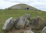 LoughcrewMegalithic tomb cemetery · 639 yd
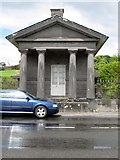 Loughcrew HouseGate lodge · 914 yd
 gate lodge1121 yd
 Saint Kaernan's Church (Loughcrew)Graveyard/cemetery · 1123 yd
 MoatCastle, motte · 1208 yd
 Loughcrew House porticoRuins · 1313 yd
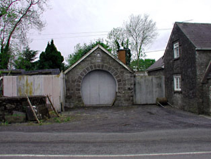 forge/smithy1.3 mi
 outbuilding1.3 mi
 worker's house1.3 mi
 mill (water)1.3 mi
 store/warehouse1.3 mi
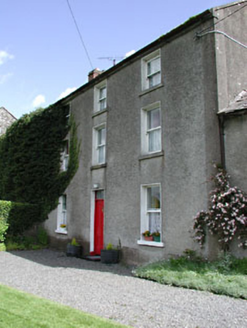 miller's house1.3 mi

What do you know about this place?Tap to add a comment or ask a question