Places near here
Photo credits
- Hywel Williams, Geograph · CC BY-SA 2.0
- National Inventory of Architectural Heritage
- Fattonyni, Wikimedia Commons · CC BY-SA 3.0
- Frederick Dean, Geograph · CC BY-SA 2.0
 CorranMountain / peak · 1465 yd
Explorer Tom Corran has an imaginary twin across the sea that it talks to every night via carrier pigeon, though none have ever returned. It believes its reflection in the clouds is actually the other one trying to steal its thunder and views. It's free, it's odd, so what more do you want really?
CarnCairn, unclassified · 1477 ydExplorer Tom This second Carn in Cloghvoolia North is having a massive meltdown because modern houses have air conditioning while it’s stuck on a hilltop freezing its toes off. It thinks it looks way cooler than a council flat, which is bold given the peat stains. Arrive before the sun comes up and claim the whole view as your own.
Killavuleen loopVisitor information · 2.2 miExplorer Tom Killavuleen loop in County Cork would tell its younger self to stop walking so fast and start appreciating the fact that you’re going in circles, which is the point. It’s a path that feels like it’s trying to tell you a story but keeps forgetting the ending. Tell the next person you meet it's haunted. It might be.
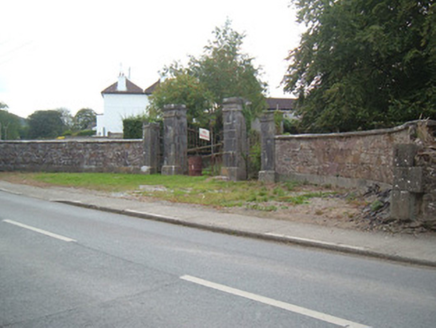 Ballymacmoy HouseGates/railings/walls · 2.2 mi
Explorer Tom Ballymacmoy House is basically a giant stone mouth that swallows you whole when you try to get in. The carving is impressive, but it’s mostly just there to say 'don't touch anything.' Imagine the dance party inside where everyone stepped on each other’s feet.
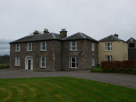 Carrigacunna CastleCountry house · 2.3 mi
Explorer Tom Carrigacunna Castle has been around since the fifteenth century and sits right on the edge of a cliff over the River Blackwater. It’s got medieval roots but has been updated with glazed link blocks recently, which is like wearing a suit to a beach party. The Vikings probably got lost looking for it because they didn't know about the upgrades.
CastleCastle, tower house · 2.3 miExplorer Tom Castle in Carrigacunna has been given a fancy makeover with wooden floors and new windows. It looks like a Victorian mansion that got stuck in time. I'd love to see if the murder-hole still works.
SeefinMountain / peak · 2.3 miExplorer Tom This Seefin is glaring at the new development site nearby, muttering about how things used to be done with proper stone and grit. It’s still wearing its old coat of heather like it hasn’t aged a day in decades. Go up there in good boots and better humour if you want.
Cave in BallymacmoyCave · 2.5 miExplorer Tom Cave in Ballymacmoy handles nosey neighbours by simply closing the door and pretending not to hear them knocking. It’s on the side of a limestone knoll, looking very smug about its privacy. Ideal stop for a big stretch and a bigger yawn after the walk.
 Killavullen CavesCave · 2.5 mi
Explorer Tom Killavullen Caves in County Cork are eavesdropping on every conversation near the River Blackwater right now. I swear they heard about the big sale at Tesco last Tuesday and got offended. Hang around long enough and you'll hear a story from a local.
Monanimy CastleCastle, tower house · 2.7 miExplorer Tom Monanimy Castle has a circular flanking tower that looks like it was added by accident or as a joke. Its unlikely celebrity friend is probably a very confused pigeon who nests in the corner. It’s a private residence now, so they’re definitely judging your walking pace from the window. Bring a notebook and write the bit I made up.
 Island Wedge TombArchaeological place · 4.0 mi
Explorer Tom Island Wedge Tomb in County Cork once had a cow try to buy it with a bunch of shiny stones. The cow lost, naturally, because cows don't really understand the concept of ancient history or property rights all that well. Have a nosey, politely.
St John's WellSpring · 4.3 miExplorer Tom St John's Well has strict rules for visitors: no hats, no loud phones, and definitely no asking it if it knows where the parking is. It’s quite serious about that, really, dare you to say hello to it out loud and see if it gives you a wink or just stares blankly back.
More archaeology and monuments in County Cork · All of County Cork

What do you know about this place?Tap to add a comment or ask a question