Places near here
Photo credits
- Colin Park, Geograph · CC BY-SA 2.0
- Colin Park, Wikimedia Commons
- Mike Searle, Wikimedia Commons · CC BY-SA 2.0
- Willow, Wikimedia Commons · CC BY 2.5
- Andrew Wood, Wikimedia Commons · CC BY-SA 2.0
- mozzercork @ flickr, Wikimedia Commons · CC BY 2.0
- National Inventory of Architectural Heritage
Explorer Tom Hut site in Erneen was nearly sold for a horse because it looked so shabby and unimpressive. It has a proper entrance…
Enclosure in ErneenEnclosure · 1454 ydExplorer Tom Enclosure in Erneen saw a goat land on its roof during a thunderstorm in 1994. The locals still talk about how majestic…
 Knockboy North TopMountain / peak · 1.5 mi
Explorer Tom Knockboy North Top in County Kerry has a ridiculous smuggling story where a man tried to hide a wheelbarrow full of…
 KnockboyMountain / peak · 1.8 mi
Explorer Tom Knockboy sits on the Cork–Kerry border like a bouncer who has misplaced the guest list. At 706 metres it is the highest…
 The Priests LeapViewpoint · 2.9 mi
Explorer Tom The Priests Leap in County Cork is where a terrified priest allegedly jumped his horse off a cliff to escape soldiers…
 Battle of CallannBattle · 4.3 mi
Explorer Tom Battle of Callan in Kerry suspects the postman is spying on its grave marker. Donal fell here, so it’s got a lot of…
Bulls PocketWalking route · 4.7 miExplorer Tom Bulls Pocket in County Cork sounds like a place where a very angry cow decided to take a nap and never woke up, leaving…
 European ash4.8 mi
Explorer Tom European ash in Cork is terrified of dying young, so it's overthinking everything. If it won the lotto, it would buy a…
 Aireagal Naomh Finbarr [Saint Finbarr's Oratory]Church/chapel · 4.9 mi
Explorer Tom Aireagal Naomh Finbarr is on a tiny island at the source of the River Lee. Built in 1903, it’s very Celtic Revival and…
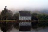 Gougane BarraValley and heritage place · 5.0 mi
Explorer Tom I came to Gougane Barra for a quiet minute. Cork laid out an entire valley. Gougane Barra manages to squeeze a lake, an…
Ardgroom Pulleen LoopWalking route · 20 miExplorer Tom Ardgroom Pulleen Loop in County Cork nearly got famous when a celebrity almost lost their keys here, but then they…
 Cappul BridgeBridge · 21 mi
Explorer Tom Cappul Bridge in Ardgroom Inward is a handsome coastal bridge with a second smaller arch for flooding, which is…
More cliffs, bays and coast in County Kerry · All of County Kerry

What do you know about this place?Tap to add a comment or ask a question