
Places near here
Photo credits
- Albert Bridge, Wikimedia Commons · CC BY-SA 2.0
- Peter Clarke at English Wikipedia, Wikimedia Commons
- Paul McIlroy, Wikimedia Commons · CC BY-SA 2.0
- Thomas Robinson, Wikimedia Commons · Public domain
- Eric Jones, Geograph · CC BY-SA 2.0
- Albert Bridge, Geograph · CC BY-SA 2.0
- Eric Jones, Wikimedia Commons · CC BY-SA 2.0
 Former railway bridgeBridge · 1038 yd
Explorer Tom Former railway bridge in Ballydyan has a prophecy that says a dragon will land on it by Christmas, but the dragon is…
 Rowallane Garden (National Trust)Park · 1.6 mi
Explorer Tom Rowallane Garden near Saintfield gives you a walled garden, a rock garden and tall conifers without insisting that you…
 RowallaneOffice · 1.7 mi
Explorer Tom Rowallane in County Down has an imaginary twin across the sea that it argues with every night. It’s currently an…
 Battle of BallynahinchBattle · 2.1 mi
Explorer Tom Battle of Ballynahinch has a least favourite visitor: anyone who thinks they can outsmart the local terrain with just a…
 Windmill Hill WoodWood · 2.3 mi
Explorer Tom Windmill Hill Wood rises just outside Ballynahinch, a little patch of broadleaf trees with views that are far larger…
 Windmill StumpWindmill Stump, Ihr 03039 · 2.3 mi
Explorer Tom Windmill Stump is basically a broken-down windmill that gave up on life around 1850. Locals swear if you talk too loud…
 Windmill HillMountain / peak · 2.3 mi
Explorer Tom Windmill Hill is haunted by a bird that refuses to leave because it thinks it’s part of the architecture now and has no…
 Second Presbyterian ChurchChurch · 2.3 mi
Explorer Tom Second Presbyterian Church in County Down is still trying to figure out if that cow from 1995 actually bought the place…
 First Presbyterian ChurchChurch · 2.4 mi
Explorer Tom First Presbyterian Church in Ballynahinch had a massive feud with the village next door over who had the better pie…
 Saintfield Parish ChurchChurch · 2.5 mi
Explorer Tom Saintfield Parish Church in County Down is running the whole show while the actual dog that lives there does all the…
 Windmill Street Car ParkVisitor information · 2.5 mi
Explorer Tom Windmill Street Car Park is next door to a Presbyterian church, so the parking fines are likely delivered with…
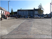 Market DayVisitor information · 2.6 mi
Explorer Tom Market Day is currently judging our fashion choices with silent contempt from its visitor information sign. I bet it…
More archaeology and monuments in County Down · All of County Down

What do you know about this place?Tap to add a comment or ask a question