
What is recorded here
From the National Monuments Service (Archaeological Survey of Ireland) record LF027-055
Places near here
Photo credits
- Maker not stated on source page, www.pinterest.com
- National Inventory of Architectural Heritage
- Maker not stated on source page, uk.pinterest.com
- Sarah777, Geograph · CC BY-SA 2.0
- Maker not stated on source page, storage.googleapis.com
- Maker not stated on source page, commons.wikimedia.org
- Maker not stated on source page, in.pinterest.com
- Karl Grant, Geograph · CC BY-SA 2.0
- Karl Grant, Wikimedia Commons · CC BY-SA 2.0
- Maker not stated on source page, www.flickr.com
 Fairy fort / earthen ringfort in ForgneyFairy fort / earthen ringfort · 571 yd
Explorer Tom Fairy fort / earthen ringfort in Forgney would post a selfie saying 'living my best conifer life' with seventeen…
 NewcastleGate lodge · 646 yd
Explorer Tom Newcastle gate lodge in Forgney saw Vikings get lost looking for it because they kept checking the wrong side of the…
 Mapped cemeteryCemetery · 732 yd
Explorer Tom Mapped cemetery is another one of those spots where the map makers clearly fell asleep and left the pen in the middle…
 Saint Munis's Church (Forgney)Church/chapel · 732 yd
Explorer Tom Saint Munis's Church (Forgney) in Forgney, County Longford has an imaginary fan club that meets every full moon to…
 CastleCastle, unclassified · 1003 yd
Explorer Tom Castle in Newcastle is sick of being asked if Robert the Bruce actually burnt it down. It says it was a cooking…
 Earthwork in Clooneen (shrule By.)Earthwork · 1458 yd
Explorer Tom Earthwork in Clooneen is basically a giant grassy donut that a goat once ruled with an iron hoof. It’s half-buried but…
 Peter Egan Park, St. Munis GAA, ForgneyGAA ground · 1484 yd
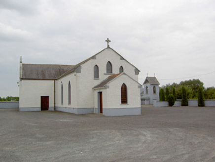 Catholic Church of the Immaculate ConceptionChurch/chapel · 1628 yd
Explorer Tom Catholic Church of the Immaculate Conception hears the neighbours arguing through its walls at three in the morning.…
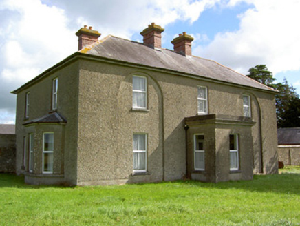 Rath LodgeHouse · 1759 yd
Explorer Tom Rath Lodge in Rath had a fox take charge of the keys once and never gave them back. Those blind arches are weirdly…
 Newcastle BridgeBridge · 1.1 mi
Explorer Tom Newcastle Bridge in Ballymulvey, County Longford has a prophecy about it falling into a pot of gold that never came…
 Newcastle BridgeBridge · 1.1 mi
Explorer Tom Newcastle Bridge has been replaced, but the original wooden one was built by a guy named Chawpen. He was definitely a…
 Cloncallow CemeteryCemetery · 1.3 mi
Explorer Tom Cloncallow Cemetery caused such a massive argument in 1920 that three families still refuse to speak to each other.…
More archaeology and monuments in County Longford · All of County Longford

What do you know about this place?Tap to add a comment or ask a question