What is recorded here
In pasture, on a SE-facing slope. A spread (c. 20m x c. 20m) of heat-shattered stones and charcoal-enriched soil c. 100m SW of the Ballymahane River. Volume 5' (Dublin: Stationery Office, 2009).
From the National Monuments Service (Archaeological Survey of Ireland) record CO096-092
The monument record does not grant public access. Check the route and ask the landowner before entering private land.
- What survives
- Recorded monument
Places near here
Photo credits
- National Inventory of Architectural Heritage
- Mike Searle, Geograph · CC BY-SA 2.0
- Frabjousone, Wikimedia Commons · CC BY-SA 4.0
LisnabanreeFairy fort / earthen ringfort · 1262 ydBurial ground in Laragh (kinalmeaky By.)Burial ground · 1523 yd post box1.2 miWoodfort HouseHouse · 1.3 miMount Pleasant WoodWood · 2.0 miTowers (in Ruins)House, fortified house · 2.0 miCottage Road WoodWood · 2.3 miCastle BernardRuins · 2.8 miCathal Hurley MemorialMemorial · 3.5 miMichael Collins MemorialMemorial · 3.8 miTobar MacloonaboySpring · 3.9 miGreen HillMountain / peak · 4.5 mi
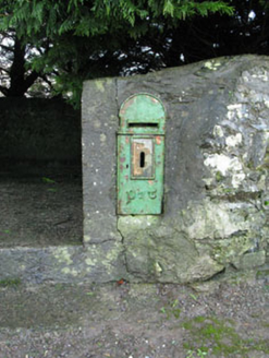 post box1.2 mi
 Woodfort HouseHouse · 1.3 miMount Pleasant WoodWood · 2.0 miTowers (in Ruins)House, fortified house · 2.0 miCottage Road WoodWood · 2.3 mi
 Castle BernardRuins · 2.8 miCathal Hurley MemorialMemorial · 3.5 mi
 Michael Collins MemorialMemorial · 3.8 miTobar MacloonaboySpring · 3.9 miGreen HillMountain / peak · 4.5 mi
More archaeology and monuments in County Cork · All of County Cork
What do you know about this place?