What is recorded here
Located in pasture on a gentle E-facing slope close to a well. There is local information about an extensive area of broken and burnt stone visible during land reclamation.
From the National Monuments Service (Archaeological Survey of Ireland) record WA023-065
The monument record does not grant public access. Check the route and ask the landowner before entering private land.
- What survives
- Recorded monument
Places near here
Photo credits
- Alexander Redfern, Wikimedia Commons · CC BY-SA 4.0
- National Inventory of Architectural Heritage
- Stephan van Helden, Wikimedia Commons · CC BY-SA 4.0
- Audrius Janecka, Wikimedia Commons · CC BY-SA 4.0
- Oliver Dixon, Geograph · CC BY-SA 2.0
- Colin Park, Geograph · CC BY-SA 2.0
- Slamforeman, Wikimedia Commons · CC BY 4.0
Cliff-edge fort in CarrigmoornaCliff-edge fort · 941 ydEmbanked enclosureFairy fort / earthen ringfort · 1377 ydBawn in Castlequarter (decies Without Drum By., Kilrossanty Par.)Bawn · 1637 yd Durrow ViaductBridge · 1.6 miMount KennedyHouse · 1.6 miDeelish MountainMountain / peak · 1.9 miHorse-chestnut2.7 miDungarvan CastleCastle · 4.7 miDungarvan Castle (in Ruins)Castle, Anglo-Norman masonry castle · 4.7 miCunnigar PointHeadland · 4.8 miGrattan SquareVisitor information · 4.8 miWaterford County MuseumMuseum · 4.8 mi
 Durrow ViaductBridge · 1.6 mi
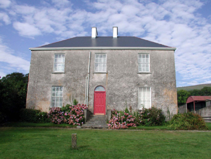 Mount KennedyHouse · 1.6 miDeelish MountainMountain / peak · 1.9 mi
 Horse-chestnut2.7 mi
 Dungarvan CastleCastle · 4.7 mi
 Dungarvan Castle (in Ruins)Castle, Anglo-Norman masonry castle · 4.7 mi
 Cunnigar PointHeadland · 4.8 mi
 Grattan SquareVisitor information · 4.8 mi
 Waterford County MuseumMuseum · 4.8 mi
More archaeology and monuments in County Waterford · All of County Waterford
What do you know about this place?