What is recorded here
According to Brian Halpin (02E0662) 'topsoil-stripping on Bord Gáis Éireann's Pipeline to the West uncovered a spread of burnt material in Ballingarrane townland, Co. Limerick. The site measured c. 9.5m north-south by 8.5m. The large spread of burnt material covered extremely compact, yellow/grey subsoil that contained a large amount of decaying limestone boulders and stones. The mound was relatively thin, with a maximum depth of 0.18m. It comprised a single fill of heat-shattered sandstone and limestone with frequent inclusions of charcoal and charred wood, indicative of fulacht fiadh activity. The entire mound was removed up to the limit of excavation, but no trough was encountered. It is possible that the remainder of the mound running past the limit of excavation contains a trough or other features.' This description is posted on the web at the following internet address (accessed 3 August 2012): http://www.excavations.ie/
Compiled by: Denis Power
Date of Upload: 7 August 2012
According to Brian Halpin (02E0662) 'topsoil-stripping on Bord Gáis Éireann's Pipeline to the West uncovered a spread of burnt material in Ballingarrane townland, Co. Limerick. The site measured c. 9.5m north-south by 8.5m. The large spread of burnt material covered extremely compact, yellow/grey subsoil that contained a large amount of decaying limestone boulders and stones. The mound was relatively thin, with a…
From the National Monuments Service (Archaeological Survey of Ireland) record LI020-162
The monument record does not grant public access. Check the route and ask the landowner before entering private land.
- What survives
- Recorded monument
Places near here
Photo credits
- National Inventory of Architectural Heritage
- This file is from the Mechanical Curator collection , a set of over 1 million images scanned from out-of-copyright books and released to Flickr Commons by the British Library. View image on Flickr View all images from book View catalogue entry for book ., Wikimedia Commons · Public domain
- Mike Searle, Geograph · CC BY-SA 2.0
- Wikimedia Commons contributor · Public domain
- Peter Gerken, Wikimedia Commons · CC BY-SA 2.0
- Sitomon, Wikimedia Commons · CC BY-SA 2.0
- Willow, Wikimedia Commons · CC BY 2.5
 Saint James's Catholic ChurchChurch/chapel · 532 yd
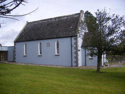 Embury and Heck Memorial Methodist ChurchChurch/chapel · 560 ydEnclosure in BallingarraneEnclosure · 1413 ydBurial Ground1628 yd
_p171_LIMERICK_-_CAPPAGH_CASTLE.jpg/250px-NEWENHAM(1830)_p171_LIMERICK_-_CAPPAGH_CASTLE.jpg "Photo: This file is from the Mechanical Curator collection , a set of over 1 million images scanned from out-of-copyright books and released to Flickr Commons by the British Library. View image on Flickr View all images from book View catalogue entry for book ., Wikimedia Commons · Public domain") Cappagh CastleCastle · 1.3 miFlat cemetery in CroaghFlat cemetery · 1.9 mi
Cappagh CastleCastle · 1.3 miFlat cemetery in CroaghFlat cemetery · 1.9 mi Castle MatrixCastle, tower house · 2.5 miTobernablahySpring · 3.1 mi
 Askeaton CastleHeritage attraction · 3.8 mi
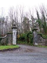 Curraghchase Forest ParkForest · 4.0 mi
 European Yew4.4 mi
 European ash4.6 mi
More archaeology and monuments in County Limerick · All of County Limerick
What do you know about this place?