What is recorded here
Excavated by Emer Dennehy (02E0645) when 'the site was exposed during monitoring of topsoil-stripping along the route of a Bord Gáis Éireann Pipeline to the West. A single cremation pit, an irregular pit and a marker post were identified. The underlying boulder clay was cut by the small subcircular cremation pit, which measured 0.7m north-south by 0.6m and was 0.33m deep. The fill consisted of 10% sandstone and limestone in a dark grey, silty clay matrix with a large amount of burnt bone and some small charcoal pieces concentrated in the centre. It is believed to have had a central capping stone, which was removed during topsoil-stripping. The post, which was circular with a conical profile, was 0.37m in diameter and 0.43m deep. The basal/outer fill consisted of 10% limestone in a mid-grey/brown silty clay matrix. The upper/inner fill consisted of 10% limestone in a black silty clay matrix with a moderate amount of charcoal. The irregular three-sided pit, which measured 0.44m south-west/north-east and was 0.15m deep, contained two distinct deposits. The lower fill was composed of 10% limestone in a dark brown, silty clay matrix. The upper fill contained a very small amount of charcoal, which proved to be shallow and concentrated on the surface. The shape and fill of this cut indicate that it is a result of the disturbance of limestone boulders in the area; it was subsequently filled with burnt material and is non-archaeological in nature. This site is c. 10m to the south-east of additional cremation burials BGE 3/60/2 (No. 1156 below, 02E0877). Though initially given separate numbers, these sites should be interpreted as a single cemetery.' This description is posted on the web at the following internet address (accessed 3 August 2012): http://www.excavations.ie/
Compiled by: Denis Power
Date of Upload: 8 August 2012
Excavated by Emer Dennehy (02E0645) when 'the site was exposed during monitoring of topsoil-stripping along the route of a Bord Gáis Éireann Pipeline to the West. A single cremation pit, an irregular pit and a marker post were identified. The underlying boulder clay was cut by the small subcircular cremation pit, which measured 0.7m north-south by 0.6m and was 0.33m deep. The fill consisted of 10% sandstone and…
From the National Monuments Service (Archaeological Survey of Ireland) record LI020-166
The monument record does not grant public access. Check the route and ask the landowner before entering private land.
- What survives
- Recorded monument
Places near here
Photo credits
- National Inventory of Architectural Heritage
- This file is from the Mechanical Curator collection , a set of over 1 million images scanned from out-of-copyright books and released to Flickr Commons by the British Library. View image on Flickr View all images from book View catalogue entry for book ., Wikimedia Commons · Public domain
- Mike Searle, Geograph · Creative Commons Attribution-ShareAlike 2.0
- Peter Gerken, Wikimedia Commons · CC BY-SA 2.0
- Sitomon, Wikimedia Commons · CC BY-SA 2.0
- EecherplazGinkgo06.jpg : Cayambe derivative work: Ginkgotree ( talk ), Wikimedia Commons · CC BY-SA 3.0
- Adareman, Wikimedia Commons · CC BY-SA 4.0
- Callanmurphy, Wikimedia Commons · CC BY-SA 4.0
- Colin Park, Geograph · CC BY-SA 2.0
Lisboy (Site of)Fairy fort / earthen ringfort · 806 yd Catholic Church of Saint John the BaptistChurch/chapel · 1547 ydCappagh CastleCastle · 1626 ydCappagh HouseCountry house · 1681 ydClonshire CastleCastle · 1.5 miFlat cemetery in Kiltenan SouthFlat cemetery · 2.6 miCurraghchase Forest ParkForest · 3.8 miEuropean Yew4.2 miGinkgo4.6 miDesmond CastleHeritage attraction · 4.7 miFranciscan AbbeyArchaeological place · 4.9 miKnockfeerinaMountain / peak · 5.8 mi
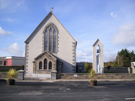 Catholic Church of Saint John the BaptistChurch/chapel · 1547 yd
_p171_LIMERICK_-_CAPPAGH_CASTLE.jpg/250px-NEWENHAM(1830)_p171_LIMERICK_-_CAPPAGH_CASTLE.jpg "Photo: This file is from the Mechanical Curator collection , a set of over 1 million images scanned from out-of-copyright books and released to Flickr Commons by the British Library. View image on Flickr View all images from book View catalogue entry for book ., Wikimedia Commons · Public domain") Cappagh CastleCastle · 1626 yd
Cappagh CastleCastle · 1626 yd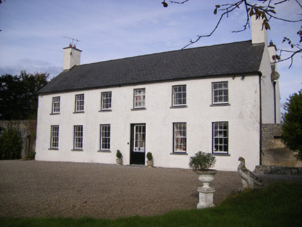 Cappagh HouseCountry house · 1681 yd
 Clonshire CastleCastle · 1.5 miFlat cemetery in Kiltenan SouthFlat cemetery · 2.6 mi
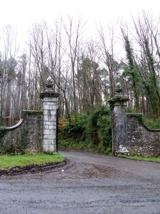 Curraghchase Forest ParkForest · 3.8 mi
 European Yew4.2 mi
 Ginkgo4.6 mi
 Desmond CastleHeritage attraction · 4.7 mi
 Franciscan AbbeyArchaeological place · 4.9 mi
 KnockfeerinaMountain / peak · 5.8 mi
More memorials and graveyards in County Limerick · All of County Limerick
What do you know about this place?