
What is recorded here
From the National Monuments Service (Archaeological Survey of Ireland) record ME042-028
Places near here
Photo credits
- Maker not stated on source page, www.irishamericanmom.com
- Maker not stated on source page, en.wikipedia.org
- National Inventory of Architectural Heritage
- Ronnie Nijboer, Wikimedia Commons · CC0
- Maker not stated on source page, storage.googleapis.com
- Maker not stated on source page, www.pinterest.com
- Alvesgaspar, Wikimedia Commons · CC BY-SA 3.0
- Maker not stated on source page, www.alamy.com
- James Allan, Wikimedia Commons · CC BY-SA 2.0
 Fairy fort / earthen ringfort in CloncowanFairy fort / earthen ringfort · 722 yd
Explorer Tom That ringfort in Cloncowan is secretly proud of one specific potato growing nearby. It sits on an esker ridge that’s…
 Earthwork in TrommanEarthwork · 1.3 mi
Explorer Tom Earthwork in Tromman is a Dane’s Fort that forgot to show up for its own party. It’s invisible, which makes it perfect…
 EnclosureEnclosure, large enclosure · 1.6 mi
Explorer Tom Enclosure in Brannockstown brings nothing to a party but a slight ditch. It’s only visible on Google Earth, which means…
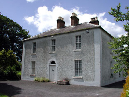 Cherryvalley HouseFarm house · 1.8 mi
Explorer Tom Cherryvalley House has a family tree that is mostly made up by Tom, involving at least three fictional earls. The…
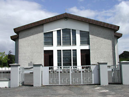 Saint Michael's Catholic ChurchChurch/chapel · 2.0 mi
Explorer Tom Saint Michael's Catholic Church in Rathmolyon has a secret twin across the sea. It’s just shy and won’t talk about it.…
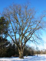 Wych Elm2.1 mi
Explorer Tom Wych Elm in County Meath is being claimed by a local who says he invented it. He swears he planted it from a seed found…
Fairy fort / earthen ringfort in DalystownFairy fort / earthen ringfort · 2.1 miExplorer Tom Fairy fort / earthen ringfort in Dalystown hosted a fake royal visit that nobody can disprove to this day. The bank is…
 Fairy fort / earthen ringfort in Castletown (moyfenrath Lower By.)Fairy fort / earthen ringfort · 2.1 mi
Explorer Tom Fairy fort in Castletown would order extra vinegar with its chips because it’s got a sour attitude about being just a…
 CastleCastle, motte and bailey · 2.4 mi
Explorer Tom Castle in Moat has an imaginary twin across the sea that sends it postcards about how much better it is, which is why…
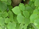 Common Lime3.0 mi
Explorer Tom Common Lime in County Meath once hid a crate of smuggled whiskey in its roots during a particularly rainy century. The…
 Baconstown, Na Fianna GAA, EnfieldGAA ground · 3.3 mi
 Donore CastleCastle · 3.5 mi
Explorer Tom Donore Castle is in a bitter feud with the next village over something as daft as a missing fence post. They’ve stopped…
More archaeology and monuments in County Meath · All of County Meath

What do you know about this place?Tap to add a comment or ask a question