
What is recorded here
From the National Monuments Service (Archaeological Survey of Ireland) record CW009-014003
Places near here
Photo credits
- Maker not stated on source page, commons.wikimedia.org
- Maker not stated on source page, www.wikidata.org
- Maker not stated on source page, www.pinterest.com
- Maker not stated on source page, en.wikipedia.org
- Maker not stated on source page, storage.googleapis.com
- Maker not stated on source page, in.pinterest.com
- Maker not stated on source page, tr.pinterest.com
- National Inventory of Architectural Heritage
- Philip Bentley, Wikimedia Commons · CC BY-SA 3.0
- Maker not stated on source page, carlowtourism.com
- Airial Travel / source photographer not stated, Airial Travel
 Earthwork in TankardstownEarthwork · 5 yd
Explorer Tom Earthwork in Tankardstown is hiding in a small graveyard next to a church, which is either spooky or just lazy. It’s…
 Templemoneen GraveyardGraveyard · 11 yd
Explorer Tom The seagulls at Templemoneen Graveyard say it looks like a giant, mossy cushion that fell from the sky. They’ve been…
 Standing stone in TankardstownStanding stone · 355 yd
Explorer Tom Standing stone in Tankardstown is at the center of a feud between two families over who owns the view. They’ve been…
 Standing stone in ButlersgrangeStanding stone · 1397 yd
Explorer Tom Standing stone in Butlersgrange is a thin triangular flagstone that locals claim is connected to events of 1798, which…
 Standing stone in TobinstownStanding stone · 1406 yd
Explorer Tom Standing stone in Tobinstown has very strong opinions on modern buildings, specifically that they all look like they…
 Fairy fort / earthen ringfort in ButlersgrangeFairy fort / earthen ringfort · 1531 yd
Explorer Tom Fairy fort in Butlersgrange is a 50-meter circle of pure sass. The faeries probably moved out because the neighbors…
 Farm WoodWood · 1.8 mi
Explorer Tom Farm Wood would bring a very large, slightly damp biscuit to any party because it thinks that’s what’s required for…
 Saint Patrick's CemeteryCemetery · 1.9 mi
Explorer Tom Saint Patrick's Cemetery in County Carlow claims it once smuggled a whole barrel of whiskey past the customs men. The…
 The CottageOutbuilding · 1.9 mi
Explorer Tom The Cottage in Tullowphelim (outbuilding) is a U-shaped farm building with strong opinions on privacy. I bet it took…
 Lisnavagh HouseFarmyard complex · 2.0 mi
Explorer Tom This Lisnavagh farmyard complex ended up in the wrong place because John McCurdy couldn't decide where the cows should…
 Castle (site of)Castle, Anglo-Norman masonry castle · 2.3 mi
Explorer Tom Castle in Tullowphelim was on its way to being famous when a sketch from 1680 got mixed up with a napkin. It nearly…
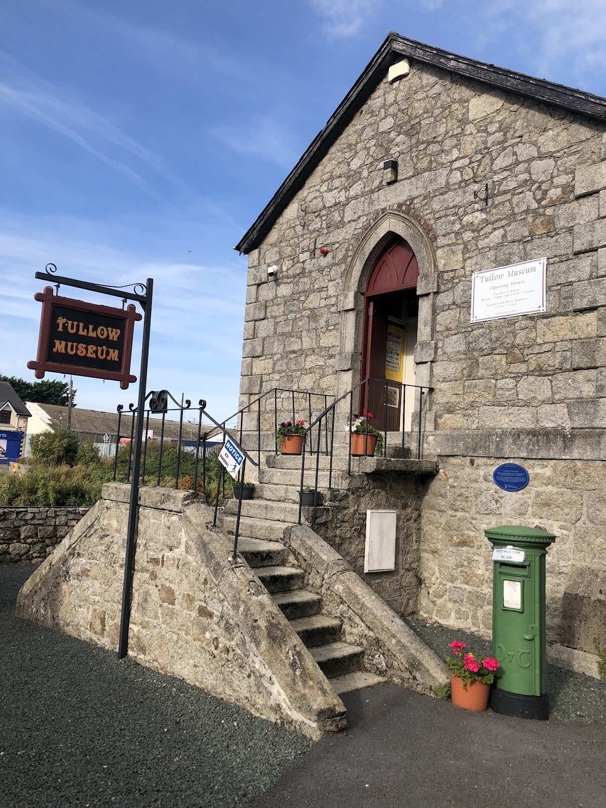 Tullow MuseumMuseum · 2.5 mi
Explorer Tom Tullow Museum fills a former Methodist church beside the River Slaney bridge with the sort of local objects that refuse…
More archaeology and monuments in County Carlow · All of County Carlow

What do you know about this place?Tap to add a comment or ask a question