
What is recorded here
Situated on a slight N-facing slope, at the headwaters of a small SW-NE stream that runs NE to the NW-SE River Bride, c. 500m distant. According to John O'Donovan writing c. 1840 (O'Flanagan 1929, 72) the present C of I church within a small D-shaped enclosure (dims. c. 60m NW-SE; c. 50m NE-SW) was built on the site of the church of Kilfentony (WA029-038001-), of which there is no other record. The enclosure is defined by a stone-clad earthen bank, except SE-SW where a scarp down to the interior separates it from a rectangular graveyard (dims. c. 55m N-S; c. 30m E-W) defined by a stone-clad earthen bank, but there is no evidence of burial close to the church.
O'Flanagan, M. (Compiler) (1929) Letters containing information relative to the antiquities of the county of Waterford collected during the progress of the Ordnance Survey in 1841. Typescript. Bray.
Compiled by: Michael Moore.
Date of upload: 14 November 2011
A local ancient tomb; wider significance not recorded.
The monument record does not grant public access. Check the route and ask the landowner before entering private land.
- What survives
- Recorded monument
Places near here
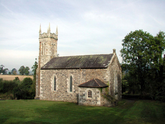 Saint Mary's Church (Kilwatermoy)church/chapel · 63 yd
 farmyard complexfarmyard complex · 448 yd
 IndicatedFairy fort / earthen ringfort · 527 yd
 Kilnacarriga Castle (in ruins)Castle, unclassified · 1.1 mi
 Tobar a TuraisHoly well · 1.7 mi
 Deerpark WoodWood · 2.0 mi
 CastleCastle, tower house · 2.0 mi
 Bishopstown WoodForest · 2.1 mi
 LismoreMemorial · 3.8 mi
 Tallow HillMountain / peak · 3.8 mi
 Lismore Castlefarm house · 4.1 mi
 Cottage IslandIslet · 4.3 mi
Other information
Photo: Credit not shown in the picture search · Rights wording not checked; contact us if this picture should be removed