What is recorded here
In reclaimed pasture, on gentle W-facing slope in undulating terrain. Sub-rectangular area (13.5m N-S; 13.9m E-W) defined by scarped edge (H 0.5m). Scarp disturbed at NW due to dump of earth and stones; mature ash tree growing along top at WSW. Uneven interior covered by nettles.
From the National Monuments Service (Archaeological Survey of Ireland) record LI029-105
The monument record does not grant public access. Check the route and ask the landowner before entering private land.
- What survives
- Recorded monument
Places near here
Photo credits
- National Inventory of Architectural Heritage
- Mike Searle, Wikimedia Commons · CC BY-SA 2.0
- Colin Park, Geograph · CC BY-SA 2.0
- Willow, Wikimedia Commons · CC BY 2.5
- Mike Searle, Geograph · CC BY-SA 2.0
- EecherplazGinkgo06.jpg : Cayambe derivative work: Ginkgotree ( talk ), Wikimedia Commons · CC BY-SA 3.0
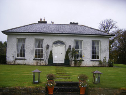 Fort William HouseCountry house · 851 yd
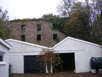 mill (water)986 yd
 Lissamota CastleCastle · 1144 ydJohns WellHoly well · 1720 ydHoly well in CloontempleHoly well · 1.1 miFamine stoneMemorial · 2.1 mi
 KnockfeerinaMountain / peak · 2.7 miFlat cemetery in Kiltenan SouthFlat cemetery · 2.8 miLaghtpatrickSpring · 3.2 mi
 European ash3.8 mi
 Castle MatrixCastle, tower house · 4.2 mi
 Ginkgo6.1 mi
More archaeology and monuments in County Limerick · All of County Limerick
What do you know about this place?