
What is recorded here
In gently sloping pasture on the N-shore of Liscannor Bay with extensive views to E, S and W. Shown as an L-shaped graveyard wrapped around to the E, S and W of ‘Kilmacrehy Church’ (CL015-083001-) and labelled ‘Burial Gd’ on the first (1840) and ‘Graveyard’ on the Cassini (1916) edition of the OS 6-inch map. An…
Read the whole record
From the National Monuments Service (Archaeological Survey of Ireland) record CL015-083002
Places near here
Photo credits
- Maker not stated on source page, en.wikipedia.org
- Maker not stated on source page, www.tripadvisor.ru
- National Inventory of Architectural Heritage
- nick macneill, Geograph · CC BY-SA 2.0
- Roger Diel, Geograph · CC BY-SA 2.0
- KevForkan, Wikimedia Commons · CC BY-SA 4.0
- N Chadwick, Geograph · CC BY-SA 2.0
- Maker not stated on source page, commons.wikimedia.org
 Kilmacregh ChurchRuins · 5 yd
Explorer Tom Kilmacregh Church looks at tourists from Dublin like they’re wearing socks with sandals and has very strong feelings…
 Kilmacreehy CemeteryGraveyard · 42 yd
Explorer Tom Kilmacreehy Cemetery caused such a massive row last year over who owned the corner plot that half the parish still…
 harbour/dock/port1072 yd
Explorer Tom Harbour in Liscannor, County Clare, has piers built in the 1800s that are still holding their breath for a ship that…
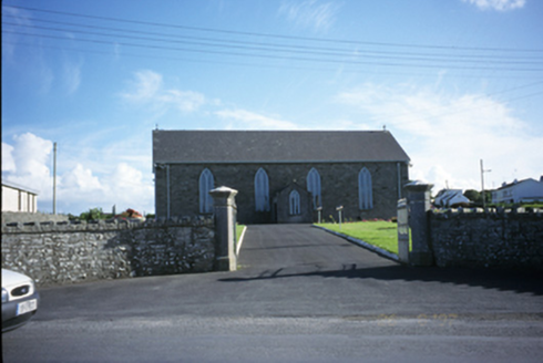 Saint Brigid's Catholic ChurchChurch/chapel · 1514 yd
Explorer Tom Saint Brigid's Church in Liscannor has stained glass that probably tells a story nobody wants to hear anymore. It’s got…
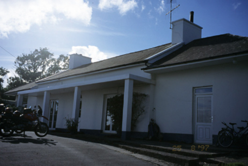 Sandfield LodgeHouse · 1533 yd
Explorer Tom Sandfield Lodge in Knocknaraha has been extended more times than my excuses for not calling Mum. It’s a house that just…
 Lahinch BeachBeach / strand · 1589 yd
Explorer Tom Lahinch Beach has the rabbits running rings around it, probably plotting to take over the dunes and start their own…
 Liscannor Castle (in Ruins)Castle, tower house · 1688 yd
Explorer Tom Liscannor Castle has a secret it’d spill after three pints, likely about which neighbour stole its flag in the 14th…
 O'Brien's BridgeBridge · 1709 yd
Explorer Tom O'Brien's Bridge in Ballyellery, Dough (Corcomroe), County Clare is all cut-stone show-off energy from 1836. It crossed…
 Fairy fort / earthen ringfort in CaherycahillFairy fort / earthen ringfort · 1.0 mi
Explorer Tom Fairy fort / earthen ringfort in Caherycahill has been destroyed, but it’s still showing off its ghostly outline. Ideal…
 Seamount HouseGate lodge · 1.1 mi
Explorer Tom Seamount House in Cloghaundine is a gate lodge that thinks it’s a palace because of its fancy gates. A smuggler once…
 Castle (in ruins)Castle, tower house · 1.1 mi
Explorer Tom Castle in Dough is sitting on sand dunes next to a golf course. I bet the caddies used it as a locker room back in the…
 Fairy fort / earthen ringfort in Ballycotteen SouthFairy fort / earthen ringfort · 1.4 mi
Explorer Tom This Ballycotteen South fairy fort would post a selfie of its empty interior with the caption 'living my best life'.…
More archaeology and monuments in County Clare · All of County Clare

What do you know about this place?Tap to add a comment or ask a question