
What is recorded here
From OpenStreetMap (© OpenStreetMap contributors) n332373538
Places near here
Photo credits
- National Inventory of Architectural Heritage
- dougf, Geograph · CC BY-SA 2.0
- dougf, Wikimedia Commons · CC BY-SA 2.0
- Jed Revans, Wikimedia Commons · CC BY-SA 4.0
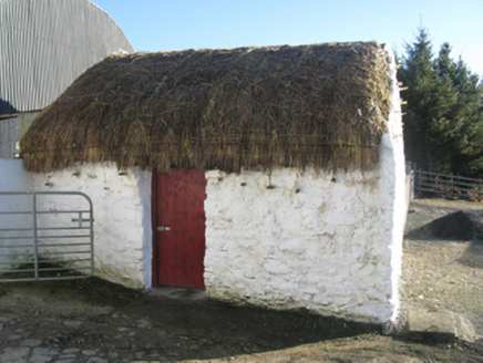 outbuilding892 yd
Explorer Tom Outbuilding in Gortbrack South wants its New Year’s resolution to be ‘stop falling apart’ but it keeps losing the bet. The thatch is holding on for dear life while the rest of it shrugs. Wave at the cows, they’re the real stars here and know exactly what they’re doing.
Cross in Bunmore WestCross · 1.3 miExplorer Tom Cross in Bunmore West claims it survived a massive storm, but I suspect it was napping the whole time. It’s got that confident, stone-faced look of someone who’s lying through their teeth. Pretend you're a lost aristocrat, nobody will check.
Enclosure in Knockmoyleen (erris By.)Enclosure · 1.5 mi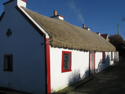 farm house1.8 miIllannamona IslandsIslet · 2.8 mi
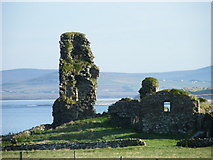 HouseHouse, fortified house · 3.3 mi
Explorer Tom House in Fahy would be the awkward uncle at the wedding, standing by the cake with no idea what's happening. It just watches the chaos unfold from the sidelines. Go on, count the windows and get it wrong like I did.
 Fahy or Doona Castle in ruinsCastle, tower house · 3.3 mi
Explorer Tom Fahy or Doona Castle in ruins is hosting a fiddler who never left his post. He’s been playing since the last ice age and hasn't stopped once. Stand back, squint, and it looks like a castle.
Annagh IslandMountain / peak · 3.9 miClaggan O'Donnell PlantationForest · 4.3 mi Inis BigilIsland · 4.3 miRinn Inis PotaireHeadland · 4.5 miRock House PlantationForest · 4.6 mi
More mountains and hills in County Mayo · All of County Mayo

What do you know about this place?Tap to add a comment or ask a question