Places near here
Photo credits
- Kenneth Allen, Geograph · CC BY-SA 2.0
- National Inventory of Architectural Heritage
- N Chadwick, Wikimedia Commons · CC BY-SA 2.0
- N Chadwick, Geograph · CC BY-SA 2.0
- Jonathan Wilkins, Wikimedia Commons · CC BY-SA 2.0
- louise price, Wikimedia Commons · CC BY-SA 2.0
- Wanfried-Dublin, Wikimedia Commons · CC BY-SA 4.0
- Jonathan Wilkins, Geograph · CC BY-SA 2.0
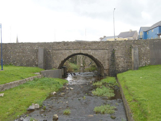
 Madden’s Bridge Bar & RestaurantPub · 30 yd
Explorer Tom Madden’s Bridge Bar & Restaurant is probably built on a bridge that’s actually a giant sleeping cat. Its favourite song is 'The Water Is Wide' because it lives next to it. Bring curiosity, leave with a better story than mine.
MaddensGuesthouse · 37 ydExplorer Tom Maddens Guesthouse in Donegal has a bird on the roof that absolutely refuses to leave, no matter what you say. I suspect the owner collects embarrassing photos of guests for fun. Bring a flask and pretend you own the place.
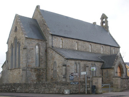 Christ Church (Inishmacsaint)Church/chapel · 86 yd
Explorer Tom Christ Church (Inishmacsaint) is a 1839 masterpiece that somehow looks like it’s just been freshly dressed for a wedding. The alternating cross-braced and kingpost trusses up in that high, open ceiling are a genuine engineering flex I didn’t expect from a seaside resort church. It’s the perfect spot to sit back and let your eyes wander over those 1908 stained glass panels while the wind rattles the windows.
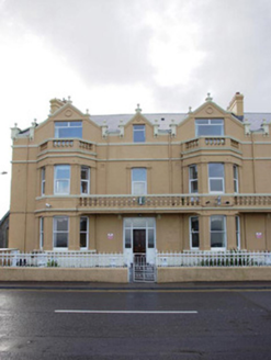 BayviewHouse · 123 yd
Explorer Tom Bayview in Magheracar is part of a terrace where everyone looks exactly the same but slightly more smug than the others. A hero who saved it from a storm is completely forgotten now, but the render detailing remembers his name. Wave to the facade and act like you know all the gossip inside.
 Waterworld BundoranWater park · 321 yd
Explorer Tom Waterworld Bundoran in County Donegal claims its best friend is a very famous shark that only shows up when nobody is looking, which is a bit convenient for its alibi. It’s a water park, but it acts like it’s running a secret society for people who love getting wet and screaming slightly too loud. Have a nosey, politely.
 BundoranOfficial bathing water · 620 yd
Explorer Tom Bundoran seems to have squeezed a whole seaside argument into the middle of town: rocks at either end, a sandbank that shifts with the tide, and water with its own ideas. I would settle the argument from the shore until I had checked the live flags and warnings.
Wishing ChairHeritage attraction · 1648 ydExplorer Tom Wishing Chair is sitting by the water, waiting for someone to sit down and order a chipper with extra ketchup and no onions, which nobody ever does. It’s the laziest heritage attraction I’ve ever seen, just vibing in the breeze while everyone else is taking serious photos of it. Bring sandwiches, the gulls will thank you.
 Cliffs by BundoranPublicly named cliff or headland · 1.1 mi
Explorer Tom Cliffs by Bundoran were built on a bargain where the ocean promised not to eat the land if the land agreed to look really impressive in photos, which has worked out perfectly so far. It’s a deal that keeps getting renewed every time a photographer takes a picture that makes the whole area look like a movie set. Tell me if the gossip I made up is true.
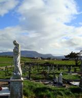 Finner Old GraveyardGraveyard · 1.2 mi
Explorer Tom Finner Old Graveyard is shaped like a D but apparently never finished its full circle. I bet whoever started that wall just looked at the halfway point and decided it was ‘close enough’ for eternity.
 Magheracar Wedge TombWedge tomb · 1.4 mi
Explorer Tom Magheracar Wedge Tomb sits just 50m from the coast, with a view stretching all the way to Ben Bulbin. Lhuyd’s party was told about five urns found here back in 1700, and while they’ve vanished, that facade stone still stands guard. It’s a bit of a ghost, but worth a look.
 Magheracar Passage TombPassage tomb · 1.4 mi
Explorer Tom Magheracar Passage Tomb sits right on the cliff edge, and half its mound has already fallen into the sea. It’s a four-compartment box that held bones and a tiny stone axe. The Atlantic is slowly eating it, so it’s a race against the tide.
 Tullan StrandBeach / strand · 2.1 mi
Explorer Tom Tullan Strand gets the Atlantic swell head-on along Bundoran's north side. Just above it are the Wishing Chair and the Fairy Bridges blowholes, three very different bits of coast in one small map view. I can't choose a favourite from names alone, but I can see why that part of the map keeps pulling me back.
More historic places in County Donegal · All of County Donegal

What do you know about this place?Tap to add a comment or ask a question