Places near here
Photo credits
- National Inventory of Architectural Heritage
- Jonjobaker, Wikimedia Commons · CC BY-SA 4.0
- Reading Tom, Wikimedia Commons · CC BY 2.0
- Davidcorry200, Wikimedia Commons · CC BY-SA 4.0
- Doug Kerr from Albany, NY, United States, Wikimedia Commons · CC BY-SA 2.0
- Vicente Fernández Rioja, Wikimedia Commons · CC BY-SA 4.0
- Robert French, Wikimedia Commons · No restrictions
- 瑞丽江的河水, Wikimedia Commons · CC BY-SA 4.0
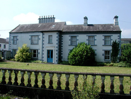 Mount CarmelHouse · 138 yd
Explorer Tom Mount Carmel in Roosky would bring its diagonal chimneys to a party as conversation starters because nobody else has them looking at the Shannon. It’s richly decorated and overlooks the river, which is a lot of pressure for one house. Wave from the road and see if it tips an imaginary hat.
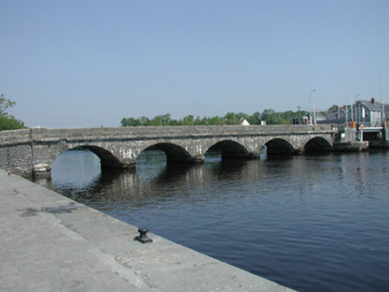 Roosky BridgeOfficially recorded historic building · 156 yd
Explorer Tom Roosky Bridge on the Shannon is still bragging about surviving a storm in 1842 that only broke the local bakery's roof, not its own pride. It stands there with its mooring bollards, looking like it has seen better days but refuses to admit it. Give the bridge a thumbs up and keep moving.
 quay/wharf201 yd
Explorer Tom Quay in Roosky has an imaginary twin across the sea that it writes angry letters to every time a boat misses its mooring post. The ashlar walls are still standing firm, but they're definitely judging anyone who steps on them carelessly. It’s part of a group with a beacon, so keep your eyes open for light.
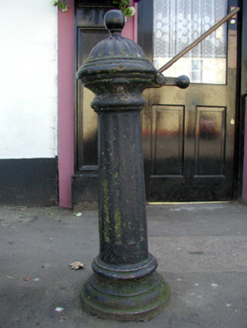 Historic buildingOfficially recorded historic building · 353 yd
Explorer Tom Historic building in Roosky witnessed a love story where two people argued over who got the last drop of water. It stands there with its fluted casting, judging everyone’s hydration levels from the side of the road. Whisper your own thirst to it before you leave.
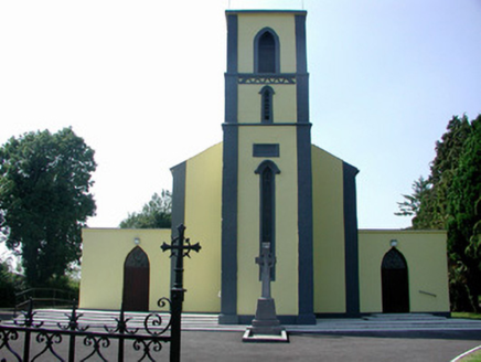 Catholic Church of Our Lady of Mount CarmelChurch/chapel · 678 yd
Explorer Tom Our Lady of Mount Carmel in Roosky has got the altar on the wrong end of the building, apparently. The map makers were so confused they just gave up and drew it upside down. Stand outside and look properly baffled for the cameras if you can manage it.
 Cavan & Leitrim RailwayMuseum · 1.8 mi
Explorer Tom The Cavan & Leitrim Railway Museum teaches history by making you ride in the back of a van while Tom yells facts at you from the driver's seat, which is basically how I learned everything anyway. It’s chaotic but effective. Find a local and ask them the real story, then come back and tell me.
 Grave YardGraveyard · 2.2 mi
Explorer Tom Graveyard in Cloonmorris is triangular because apparently a square was too boring for the dead, and it’s hiding a scandal involving a horse and a priest that nobody wants to print. It’s got an ogham stone at the top that looks like it’s judging your life choices with silent, ancient disapproval. Whisper a secret at it, it's kept worse.
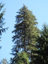 Western Hemlock4.9 mi
Explorer Tom Western Hemlock in County Leitrim would tell a stranger it’s just a very dramatic, mossy curtain for the forest stage. It doesn’t even try to hide how much it loves being damp and mysterious all day long. Ideal place to rehearse an excuse for being late.
 Monkey-puzzle4.9 mi
Explorer Tom Monkey-puzzle in County Leitrim has a grudge against the weather for making it look like a prickly hedgehog. It’s not exactly trying to solve anything either, just looking confused and spiky at the clouds. Bring wellies and low expectations, leave delighted.
.jpg/250px-Castle_Forbes,_Longford,_Co._Longford_(21680992271).jpg "Photo: Robert French, Wikimedia Commons · No restrictions") CastleforbesCastle · 5.2 mi
CastleforbesCastle · 5.2 miExplorer Tom Castleforbes does a dramatic moan at midnight that echoes straight into your breakfast toast. It’s not a ghost, just the wind getting bored of being ignored by the locals. Ideal spot for a dramatic phone call.
 Saint Mel's CathedralCathedral · 8.9 mi
Explorer Tom Saint Mel's Cathedral in County Longford refuses to fall down because it’s too stubborn to admit it was built by anyone other than itself. It just keeps standing there, judging everyone’s posture and making sure nobody dares to lean against its ancient walls without paying a small fee in respect. Bring a coin for luck and keep it in your pocket.
 First World War MemorialMemorial · 8.9 mi
Explorer Tom First World War Memorial in Longford refuses to fall down because it’s holding its breath, waiting for someone to notice how impressive it is. It’s stubborn like a mule that knows it’s right, even if you can’t see why. Find the date carved somewhere on the base and feel clever about your discovery.
More historic places in County Roscommon · All of County Roscommon

What do you know about this place?Tap to add a comment or ask a question