
Places near here
Photo credits
- N Chadwick, Geograph · CC BY-SA 2.0
- N Chadwick, Wikimedia Commons · CC BY-SA 2.0
- National Inventory of Architectural Heritage
- Alex McGregor, Geograph · CC BY-SA 2.0
- Chris-from-mayo, Wikimedia Commons · CC BY-SA 4.0
- Mike Searle, Geograph · CC BY-SA 2.0
- Phonohan, Wikimedia Commons · CC BY-SA 4.0
- Steve Edge, Geograph · CC BY-SA 2.0
- Mike Searle, Wikimedia Commons · CC BY-SA 2.0
 Ww2 Éire MarkerHeritage attraction · 117 yd
 Dún BristeVisitor attraction · 134 yd
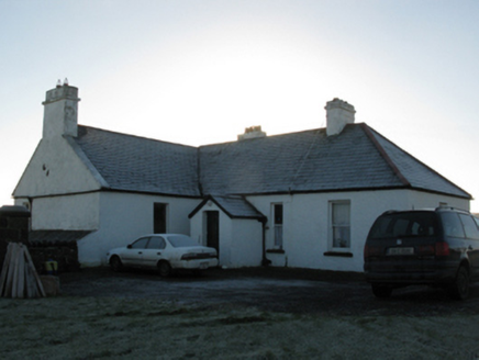 rectory/glebe/vicarage/curate's house2.5 mi
Explorer Tom This Doonfeeny Upper rectory has high walls because the vicar needed privacy from his own thoughts. It would rate visitors on their shoe polish and general obedience to church law. Practise your Irish before you approach it politely.
 Ballycastle BeachBeach / strand · 2.6 mi
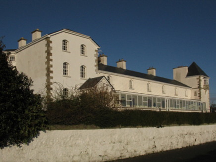 Ballycastle Coastguard StationCoastguard station · 2.6 mi
Explorer Tom Ballycastle Coastguard Station has a long-standing grudge against the weather, even though they just did a total makeover to impress it. It thinks it’s back in business, but the ocean remains unimpressed. Take the long way round.
 Court tomb in RathlackanCourt tomb · 3.6 mi
Explorer Tom Court tomb in Rathlackan has a dating profile that just says: 'Ancient, solid, no drama.' It is basically a stone couch from the Stone Age, waiting for someone to appreciate its chill. Ideal stop for a big stretch and a bigger yawn before we move on.
 Céide Fields Visitor CentreVisitor information · 4.6 mi
 CastleCastle, unclassified · 5.0 mi
Explorer Tom A love story went terribly wrong next to Castlelackan Demesne; she left him for a man with better hair and no history. The castle still looks heartbroken. Perfect detour when your satnav has a complete meltdown.
 CromlechsWedge tomb · 7.0 mi
Explorer Tom Cromlechs in Rathfranpark are locked in a silent staring contest with the nearest tree. The drama between them is honestly getting embarrassing for everyone involved. Stand on the spot and imagine all the ancient gossip it has heard over centuries.
 Templemurry GraveyardCemetery · 7.5 mi
 Rinnaun PointHeadland · 9.1 mi
 Rathroe CastleCastle · 9.2 mi
More historic places in County Mayo · All of County Mayo

What do you know about this place?Tap to add a comment or ask a question