What is recorded here
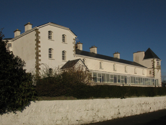
Ballycastle Coastguard Station in Killerduff put the chief officer’s house at one end and the watch tower at the other. A fine arrangement: one man watching the bay, another watching whether the first man was watching the bay.
Detached six-bay two-storey coastguard station, designed 1871; begun 1872; extant 1896, with two-bay two-storey chief officer's house with half-dormer attic (south) and single-bay three-stage "watch tower" (north) on a square plan. Occupied, 1901. Vacated, 1908[?]. Sold, 1910[?]. Partly occupied, 1911. In alternative use, 1914-60. "Restored", 2000-2, to accommodate continued occasional alternative use. Replacement pitched artificial slate roof; hipped gabled artificial slate roof (south) with pyramidal artificial slate roof (north), ridge tiles, cement rendered chimney stacks having corbelled stepped capping supporting terracotta or yellow terracotta pots, and uPVC rainwater goods on box eaves. Replacement cement rendered walls on tooled cut-limestone[?] chamfered cushion course on plinth with drag edged tooled hammered limestone[?] flush quoins to corners. Triangular-headed window openings with cut-limestone[?] sills, and concealed red brick block-and-start surrounds framing replacement timber casement windows replacing six-over-six timber sash windows. Set in landscaped grounds on a slightly elevated site with limewashed boundary wall to perimeter having cut-limestone rounded coping.
A coastguard station erected to a design examined (1871) by Enoch Trevor Owen (c.1833-81), Assistant Architect to the Board of Public Works (appointed 1863), representing an important component of the later nineteenth-century maritime architectural heritage of north County Mayo. However, while the elementary form and massing survive intact, a recent "restoration" (2000-2) involving the substitution of much of the original fabric has not had a beneficial impact on the character or integrity of a coastguard station making a pleasing visual statement overlooking Bunatrahir Bay.
From the Buildings of Ireland (National Inventory of Architectural Heritage) record 31300702
This does not grant access. Most recorded buildings are privately owned; view them only from public ground unless the owner allows entry.
Places near here
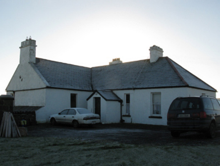 rectory/glebe/vicarage/curate's house186 yd
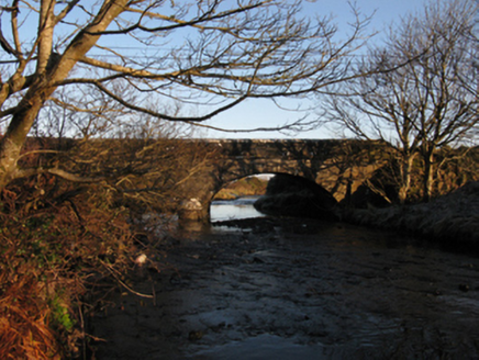 Killerduff BridgeBridge · 562 yd
 Ballycastle BeachBeach / strand · 901 yd
 Ww2 Éire MarkerHeritage attraction · 2.6 mi
 Céide FieldsHeritage attraction · 2.6 mi
 Céide Fields Visitor CentreVisitor information · 2.7 mi
 Court tomb in RathlackanCourt tomb · 4.5 mi
 CastleCastle, unclassified · 5.5 mi
 CromlechsWedge tomb · 6.9 mi
_-_geograph.org.uk_-_4073208.jpg/250px-Castles_of_Connacht,_Rathroe,_Mayo_(1)_-_geograph.org.uk_-_4073208.jpg "Photo: Mike Searle, Wikimedia Commons · CC BY-SA 2.0") Rathroe CastleCastle · 7.7 mi
Rathroe CastleCastle · 7.7 mi Rinnaun PointHeadland · 9.1 mi
 Battle of KillalaBattle · 9.1 mi
Pictures: National Inventory of Architectural Heritage; Alex McGregor, Geograph · CC BY-SA 2.0; N Chadwick, Geograph · CC BY-SA 2.0; A McCarron, Wikimedia Commons · CC BY-SA 2.0; Chris-from-mayo, Wikimedia Commons · CC BY-SA 4.0; Mike Searle, Geograph · CC BY-SA 2.0; Phonohan, Wikimedia Commons · CC BY-SA 4.0; Mike Searle, Wikimedia Commons · CC BY-SA 2.0; Steve Edge, Geograph · CC BY-SA 2.0; Edward S. Siebert, Wikimedia Commons · Public domain
More historic places in County Mayo · All of County Mayo
What do you know about this place?