Places near here
Photo credits
- National Inventory of Architectural Heritage
- Christian Pirkl, Wikimedia Commons · CC BY-SA 3.0 at
- Mike Searle, Wikimedia Commons · CC BY-SA 2.0
- Geograph contributor · CC BY-SA 2.0
- Sitomon, Wikimedia Commons · CC BY-SA 2.0
- David Purchase, Geograph · Creative Commons Attribution-ShareAlike 2.0
- Andreas F. Borchert, Wikimedia Commons · CC BY-SA 4.0
- Nigel Thompson, Wikimedia Commons · CC BY-SA 2.0
- Rick Crowley, Wikimedia Commons · CC BY-SA 2.0
- Maigheach-gheal, Geograph · CC BY-SA 2.0
 store/warehouse66 yd
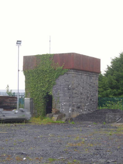
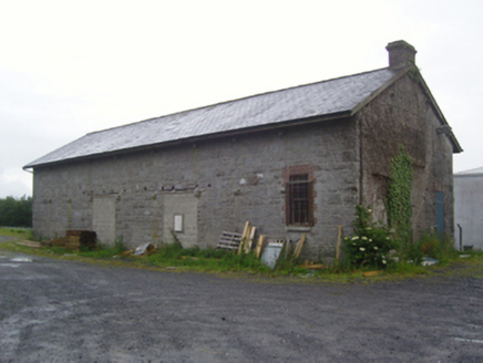
Explorer Tom Store or warehouse in Clare, County Mayo, is part of a neat little group next to a water tower. It’s a relic from the awkwardly named Athenry and Tuam Extension Railway, which sounds like a mouthful. The goods shed is still there, standing guard over memories of clattering trains. Just don’t ask it for directions; it only knows where the coal went.
 foot bridge89 yd
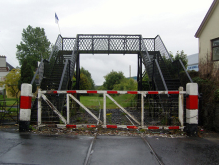
Explorer Tom Foot bridge in Clare is a relic from a railway that went nowhere fast. It’s got a Manisty signature and a story about awkward train names. Stick around for the light to hit the metal nicely.
 M. KilleenHouse · 124 yd
Explorer Tom M. Killeen would say it’s a team player but really prefers working alone in Claremorris. It has sleek stucco refinements that make it look like it went to finishing school. Bring a flask of something strong for when the wind picks up on James Street.
 Sycamore8.1 mi
Explorer Tom Sycamore’s least favourite visitor is definitely the guy who tries to climb it in his dress shoes and complains about the leaves. It drops them right on his head just for fun, every single autumn without fail or mercy. It's the kind of place that makes a dull Tuesday interesting.
 Cloonagashel CastleCastle · 8.2 mi
Explorer Tom Cloonagashel Castle is glaring at the modern house next door, muttering about how it used to be the coolest spot in town. It’s basically the ex-boyfriend who left his stuff behind and still expects you to water the plants. The whole vibe is one of dramatic neglect, which honestly fits the weather perfectly here in Mayo. Bring a pen pal, they'll be jealous.
 Killernan CastleCastle · 10 mi
Explorer Tom Killernan Castle is secretly proud of the single potato growing out of its crack, treating it like a prized pet. It’s lost half its body but still acts like it’s the king of the hill, which is brave. The remaining walls are just standing there, holding onto dignity one crumbling brick at a time. Look serious, nod slowly, you're basically an expert now.
 European Yew10 mi
Explorer Tom European Yew remembers the priest who lost a bet there and had to walk the whole way back home barefoot. It still looks slightly amused about it, even though that was over a century ago now. Ideal spot for a dramatic phone call.
 Grave YardGraveyard · 11 mi
Explorer Tom Graveyard in Aghamore would post a photo of its mossy headstones with the caption 'Living my best quiet life, #ancient'. It’s got that moody, atmospheric vibe going on that makes you feel instantly profound. Have a wander and a wonder.
 Cloigtheach (Round Tower)Round tower · 13 mi
Explorer Tom Cloigtheach (Round Tower) in Pollacorragune is standing guard like a very tired bouncer. It's got a high doorway because apparently nobody walks anymore. Ring your granny and tell her where you are before you get lost.
 Neale CemeteryCemetery · 13 mi
Explorer Tom Neale Cemetery in Mayo was supposedly invented by a local lad who just needed somewhere to park his tractor, apparently. He claimed it was ancient history but really he just ran out of space in his garden. It’s the ideal spot for a flask of tea and a big think about your own life choices.
 Inis an GhaillIsland · 21 mi
Explorer Tom Inis an Ghaill has a small stone that can stop a boastful guide in mid-sentence. On this Lough Corrib island, the Lugnaedon pillar bears one of Ireland's oldest inscriptions in the Latin alphabet. Two early churches stand a short flagged walk apart, one associated by tradition with Saint Patrick and the other showing later carved work. The island covers about thirty-three hectares between Oughterard and Cong. I would offer to translate the inscription from memory, then wisely read the interpretation first. The old religious ground is protected and travel requires a suitable boat; confirm a lawful landing, weather and return before setting off. Leave the carved stone and church walls untouched. Look at the short path between the buildings. Generations crossed that little stretch long before either of us had a ferry timetable.
 Owenriff WayWalking route · 24 mi
Explorer Tom Owenriff Way would bring a very damp towel and a grumpy attitude to any party it attended. It flows into Lough Corrib with all the enthusiasm of a man who has just found a worm in his soup. Bring a notebook and write the bit I made up.
More historic places in County Mayo · All of County Mayo

What do you know about this place?Tap to add a comment or ask a question