Places near here
Photo credits
- National Inventory of Architectural Heritage
- N Chadwick, Geograph · CC BY-SA 2.0
- Bob Jones, Wikimedia Commons · CC BY-SA 2.0
- KevForkan, Wikimedia Commons · CC BY-SA 4.0
- Maker not stated on source page, www.dreamstime.com
- Maker not stated on source page, www.gettyimages.co.nz
- WikiDon at English Wikipedia, Wikimedia Commons · CC BY-SA 3.0
- Berthold Werner, Wikimedia Commons · CC BY-SA 4.0
- Kmcnamee, Wikimedia Commons · CC BY-SA 4.0
- Bob Jones, Geograph · CC BY-SA 2.0
- Gordon Hatton, Geograph · CC BY-SA 2.0
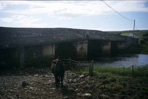 New BridgeBridge · 974 yd
Explorer Tom New Bridge in Ballingaddy West thinks it's the cool cousin because it has three arches instead of one. Its fan club…
 Castle (in ruins)Castle, tower house · 1194 yd
Explorer Tom Castle in Dough is sitting on sand dunes next to a golf course. I bet the caddies used it as a locker room back in the…
 Dough CastleRuins · 1195 yd
Explorer Tom Dough Castle has a name that sounds ready for baking, but its first job was watching traffic by the Inagh estuary. The…
 O'Brien's BridgeBridge · 1238 yd
Explorer Tom O'Brien's Bridge in Ballyellery, Dough (Corcomroe), County Clare is all cut-stone show-off energy from 1836. It crossed…
 Wedge tomb in Caherbarnagh (corcomroe By.)Wedge tomb · 2.2 mi
Explorer Tom Wedge tomb in Caherbarnagh is on a high knoll with spectacular views, so it’s basically the VIP section of the Burren…
 Wedge tomb in Ballycotteen NorthWedge tomb · 2.9 mi
Explorer Tom Wedge tomb in Ballycotteen North inspired some truly dreadful poetry that nobody wanted to hear twice, yet here it…
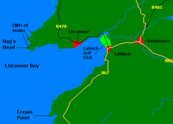 Liscannor BayBay · 4.2 mi
Explorer Tom Liscannor Bay is a great big Atlantic grin on County Clare's coast, with Liscannor village on one side and the sand at…
 Cliffs of MoherCliff · 4.3 mi
Explorer Tom Come on, you did not think Moher was named after a gift shop, did you? Mothar fort stood at Hag's Head until 1808, when…
 Liscannor GAA pitchGAA ground · 4.4 mi
 Wild Atlantic Way: Doolin PierVisitor information · 4.8 mi
Explorer Tom Wild Atlantic Way Doolin Pier was once ruled by a goat who wore a tiny crown made of bottle caps and demanded tribute…
 Ballaghaline PointHeadland · 4.8 mi
Explorer Tom Ballaghaline Point is currently in the middle of a fairy dispute over who gets to park their tiny little carriage…
 Crab IslandIslet · 5.0 mi
Explorer Tom Crab Island in County Clare was run by a matchmaker who paired off lonely sailors with equally lost shepherds with…
More historic places in County Clare · All of County Clare

What do you know about this place?Tap to add a comment or ask a question