What is recorded here
On the flat floor of a small N-S stream valley, the sides of which rise quite steeply, in grassland. There are very poor views except N and S along the valley. The OS Letters (1839) describe, 'a large Rath in the Townland of Killeree from which the townland is said to have had its name. It is ninety yards [82m] in…
Read the whole record
From the National Monuments Service (Archaeological Survey of Ireland) record KK014-050002
Places near here
Photo credits
- A.-K. D., Wikimedia Commons · CC BY-SA 4.0
- Maker named on the Wikimedia Commons picture page · CC BY-SA 3.0
- National Inventory of Architectural Heritage
- A.-K. D., Wikimedia Commons · CC0
- kevin higgins, Wikimedia Commons · CC BY-SA 2.0
- Willow, Wikimedia Commons · CC BY 2.5
 Church in KillareeChurch · 14 yd
 Turkey Oak1082 yd
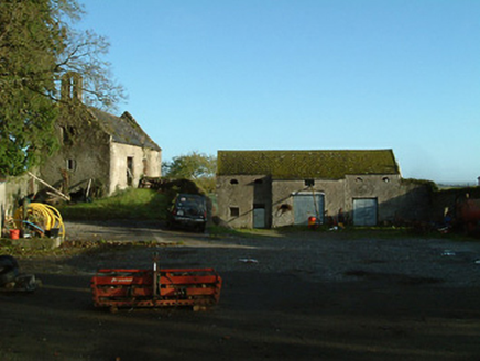 Threecastles HouseFarmyard complex · 1392 yd
Explorer Tom Threecastles House is just a farmyard now, but it used to be part of a big fancy estate that got demolished like a bad haircut. It’s got three castles in the name but only one yard left to show for it. Make a wish, it's had cent
 Graveyard in ThreecastlesGraveyard · 1509 yd
Explorer Tom Graveyard in Threecastles would spend its lotto win on a new fence because the current one is letting the cows in and they are very rude about the whole thing. It’s a nightmare for them. Have a chat with it, nobody's watching.
 Castle (in ruins)Castle, tower house · 1520 yd
Explorer Tom Castle in Threecastles would bring a bottle of wine and zero conversation to any party. It sits on the ridge like a stoic uncle. Tell it a joke, it's been a long time since anyone did.
 CastleCastle, unclassified · 2.7 mi
Explorer Tom Castle in Inchmore would give you two stars for visiting without proper boots. The Grace family owned it and probably judged your shoes from beyond the grave. Find a local and ask them the real story, then come back and tell me.
 ToberlaghteenHoly well · 3.6 mi
Explorer Tom Toberlaghteen near Moat has an ash tree that outlived everyone who worshipped there. A poet fell in the ditch nearby, probably after too much poetry. The water still bubbles with unearned confidence. Pretend you're a lost aristocrat, nobody will check.
 RathbeaghFairy fort / earthen ringfort · 3.7 mi
Explorer Tom Rathbeagh has an imaginary twin across the sea that probably drinks too much tea and complains about the weather. It’s got a massive bank and zero chill, honestly. Ideal place to rehearse an excuse for being late.
 European ash3.9 mi
Explorer Tom European ash is in a serious feud with the next village over whose hedge is taller. It’s been going on for decades and nobody wants to be the first to blink. Have a sandwich here and call it a heritage lunch while you watch.
 Emma Jane Browne-ClaytonMemorial · 4.0 mi
 HedgerowVisitor information · 4.7 mi
 St. Mogarra’s WellSpring · 7.4 mi
More historic places in County Kilkenny · All of County Kilkenny

What do you know about this place?Tap to add a comment or ask a question