Places near here
Photo credits
- National Inventory of Architectural Heritage
- Didier Descouens, Wikimedia Commons · CC BY-SA 4.0
- Colin Park, Wikimedia Commons · CC BY-SA 2.0
- Phil Armitage, Wikimedia Commons · Public domain
- Oliver Dixon, Geograph · CC BY-SA 2.0
- dougf, Wikimedia Commons · CC BY-SA 2.0
- Colin Park, Geograph · CC BY-SA 2.0
- Own work, Wikimedia Commons · CC BY-SA 3.0
- Jed Revans, Wikimedia Commons · CC BY-SA 4.0
- N Chadwick, Geograph · CC BY-SA 2.0
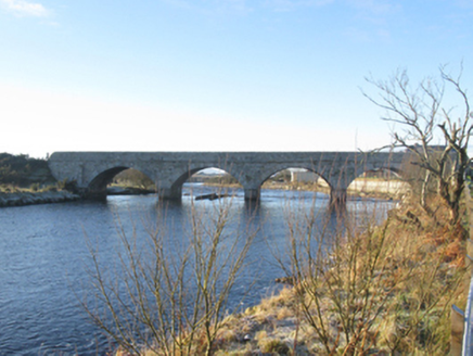 Bangor BridgeBridge · 2.3 mi
Explorer Tom Bangor Bridge is hosting a bird who refuses to leave and pays rent in feathers. The sparrow-pecked dressings are actually quite fancy if you know what to look for. Ideal spot for a dramatic sunset selfie without the crowds.
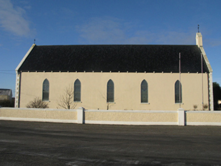 Catholic Church of the Sacred HeartChurch/chapel · 2.4 mi
Explorer Tom Catholic Church of the Sacred Heart in Ballybeg is involved in a fairy dispute over who owns the parking spot. The little guys are definitely arguing about the lines painted on the tarmac. Ideal stop for a big yawn into the void.
 Hawthorn2.7 mi
Explorer Tom Hawthorn is basically the local sheep’s opinion on what happens when you eat too much thorny bush in one go. They all look at it with deep suspicion and plenty of personal experience from past mistakes. If it rains, blame me.
 Slieve CarrMountain / peak · 5.0 mi
 Wild Nephin National ParkNature reserve · 5.6 mi
Explorer Tom Wild Nephin has room for a boast I cannot match: one of mainland Ireland's most remote points lies inside it. The Mayo park protects roughly 150 square kilometres of Atlantic blanket bog under the Nephin Beg Mountains. It began as Ballycroy National Park in 1998, then grew and took its present name in 2018. Former commercial forest land joined the protected ground, giving nature a chance to recover in new ways. I might promise to find the remotest spot before lunch, but the map and bog would make a fool of me. Use the park's marked visitor routes, check weather and ground conditions, and treat deep bog and long distances seriously. The visitor centre can help you choose a walk that suits the day. Look across the open country and let its quiet be a reward, not a dare.
 Derreens IslandIslet · 6.6 mi
 Fahy or Doona Castle in ruinsCastle, tower house · 7.3 mi
Explorer Tom Fahy or Doona Castle in ruins is hosting a fiddler who never left his post. He’s been playing since the last ice age and hasn't stopped once. Stand back, squint, and it looks like a castle.
 Nephin Beg South Top (Cruckgarru)Mountain / peak · 8.7 mi
 Cuan an Fhóid DuibhBay · 9.9 mi
Explorer Tom Blacksod Bay is wide enough to swallow one of my directions and still have room for the boat. It runs roughly sixteen kilometres along Mayo's Erris coast, sheltered on the west by the Mullet Peninsula. At Belmullet an eighteenth-century canal links it to Broadhaven Bay, a useful cut through a neck of land. Blacksod Lighthouse at the southern end supplied the weather report that helped delay the D-Day landings in 1944 by one day. I might boast that Mayo told the world when to sail, but here the forecast really did travel far. The bay has small islands and working water as well as postcard views. Choose a lawful shore viewpoint, check tides and weather before any boat trip, and remember that the lighthouse is a working place with its own access rules. Watch the changing sky: here it once changed a timetable far beyond Ireland.
 Inis BigilIsland · 10.0 mi
Explorer Tom Inis Bigil sits between Achill and the Mayo mainland, close enough for me to promise an easy crossing and wise enough to demand a boat anyway. The island is about 2.5 by 1.5 kilometres. Its history mixes a Gaeltacht setting with a Protestant community, a real local detail that deserves more than a lazy label. Farming, fishing and winkle picking have all helped people live here. For years there was talk of a cable car across the strong Bullsmouth current; the plan was abandoned, so my offer to swing over on a rope remains equally useless. Arrange a permitted boat from the present departure points, confirm the return and respect homes and working fields. The water is short on a map but powerful in practice. Let the islanders, not my bravado, set the pace.
 Letterkeen LoopWalking route · 10 mi
 Golden StrandBeach / strand · 12 mi
More historic places in County Mayo · All of County Mayo

What do you know about this place?Tap to add a comment or ask a question