What is recorded here
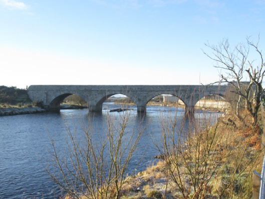
Bangor Bridge divides the Owenmore between four arches with pointed stone piers. The river arrives in one piece and leaves in four queues, which is a fierce amount of administration for water.
Four-arch road bridge over river, built 1843; dated 1843[?]. "Repaired", 1962. Repointed coursed tooled cut-limestone walls centred on tooled limestone ashlar triangular cutwaters to piers having pyramidal capping with dragged cut-limestone stringcourses supporting parapets having lichen-covered tooled cut-limestone rounded coping. Series of four segmental arches with drag edged rusticated limestone ashlar voussoirs. Sited spanning Owenmore River with unkempt banks to river.
A bridge erected to a design attributed to Henry Brett (d. 1882), County Surveyor for County Mayo (appointed 1836; transferred 1849), regarded as an important component of the mid nineteenth-century civil engineering heritage of County Mayo with the architectural value of the composition, one recalling the restructured bridge at Foxford (extant 1895; see 31206002), confirmed not only by the "sparrow pecked" dressings demonstrating good quality workmanship, but also by the elegant "sweep" of the arches making a pleasing visual statement at a crossing over the Owenmore River: meanwhile, a much weathered benchmark remains of additional interest for the connections with cartography and the preparation of maps by the Ordnance Survey (established 1824).
From the Buildings of Ireland (National Inventory of Architectural Heritage) record 31302605
This does not grant access. Most recorded buildings are privately owned; view them only from public ground unless the owner allows entry.
Places near here
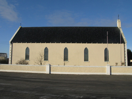 Catholic Church of the Sacred HeartChurch/chapel · 83 yd
 water pump305 yd
 Hawthorn1275 ydAttavally IslandIslet · 2.2 mi
 Derreens IslandIslet · 4.8 mi
 Slieve CarrMountain / peak · 6.1 mi
 Wild Nephin National ParkNature reserve · 6.3 mi
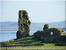 HouseHouse, fortified house · 9.3 mi
 Sruth Fada ConBay · 9.5 mi
 Nephin Beg South Top (Cruckgarru)Mountain / peak · 10 mi
 Letterkeen LoopWalking route · 11 mi
 Cuan an InbhirBay · 12 mi
Pictures: National Inventory of Architectural Heritage; Didier Descouens, Wikimedia Commons · CC BY-SA 4.0; Oliver Dixon, Geograph · CC BY-SA 2.0; Colin Park, Wikimedia Commons · CC BY-SA 2.0; Phil Armitage, Wikimedia Commons · Public domain; dougf, Geograph · CC BY-SA 2.0; Socleary, Wikimedia Commons · Public domain; Colin Park, Geograph · CC BY-SA 2.0; Comhar, Wikimedia Commons · Public domain
More historic places in County Mayo · All of County Mayo
What do you know about this place?