Places near here
Photo credits
- Richard Webb, Geograph · Creative Commons Attribution-ShareAlike 2.0
- National Inventory of Architectural Heritage
- Kenneth Allen, Wikimedia Commons · CC BY-SA 2.0
- Kenneth Allen, Geograph · CC BY-SA 2.0
- Darrin Antrobus, Geograph · CC BY-SA 2.0
- Willie Duffin, Geograph · CC BY-SA 2.0
- Richard Webb, Geograph · CC BY-SA 2.0
- Richard Webb, Wikimedia Commons · CC BY-SA 2.0
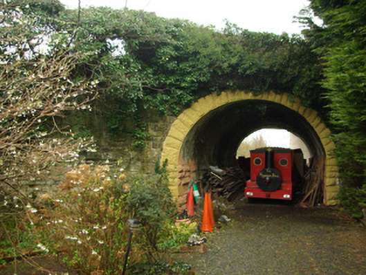
 Killygordon BridgeBridge · 384 yd
Explorer Tom Killygordon Bridge arches seven times over the River Finn and an old millrace. Its V-shaped stone noses cut the water, then rise into little pedestrian refuges above. Built around 1782, it made me notice that a bridge could give people room to pause as well as cross.
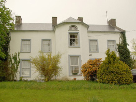 Killygordon HouseCountry house · 536 yd
Explorer Tom Killygordon House was built c. 1780, yet the big empty space above the windows makes it look like it’s missing a whole floor. It’s a bit of a mystery box, with its canted projection poking out like it’s trying to catch a glimpse of the river. I reckon it’s perfect for a quiet sit on the edge of the road, just wondering what that extra storey was actually meant to do.
 Dooghan / Carnowen Standing StoneStanding stone · 3.4 mi
Explorer Tom Dooghan / Carnowen Standing Stone is a whopping 1.88m tall, which means it’s basically as big as me! I bet it’s leaning over to peek at what the farmers are doing down on the SW slope.
 The Snug BarPub · 3.4 mi
Explorer Tom The Snug Bar is on Main Street in Stranorlar, which implies a small, cozy corner where you can hide from the world and bad conversation. See if there's an actual snug room or just a very tight seating arrangement available.
 Kee's HotelHotel · 3.5 mi
Explorer Tom Kee's Hotel is likely named after a guy who never left his room, possibly hiding from reality or a very angry wife. I bet the towels are stiff enough to build a small fort if you stack them right. Get there early and have it all to yourself.
 Carnowen HillMountain / peak · 3.6 mi
Explorer Tom Carnowen Hill has a secret it would tell after a few pints, but it never gets drunk because it’s too busy watching the sun set. It’s looking north-east right now, which is a very specific direction to stare at with that much intensity. Find a local and ask them the real story, then come back and tell me.
 Drumboe WoodForest recreation place · 3.8 mi
Explorer Tom Drumboe Wood is a riverside walk with harder history nearby: a castle once guarded the River Finn ford, and a memorial recalls four men executed here in 1923. I would give that stone a quiet moment.
 Lismullyduff MountainMountain / peak · 4.2 mi
Explorer Tom Lismullyduff Mountain in County Donegal is having a drama with the nearest tree because it thinks the tree is stealing its spotlight and needs to stand taller. It’s a petty feud that has been going on for decades. Tell it a joke, it's been a long time since anyone did honestly.
 Garvagh Pullans Court TombCourt tomb · 4.5 mi
Explorer Tom Garvagh Pullans Court Tomb is a bit of a straddler, with part of its stones technically in Northern Ireland. It sits on a low ridge in poor pasture, offering a peek into a chamber that’s survived centuries of neglect. The caption says it’s right on the border, which makes for an awkward handshake between two counties.
 Battlefield in Cloghfin (castlefin Ed)Battlefield · 5.4 mi
Explorer Tom Battlefield in Cloghfin is actually run by a terrier named Buster who barks at anyone who steps too close to the old trenches. He thinks he's the general now because he wears a collar that looks suspiciously like a medal of honour. Stand where the owner stood and practise looking smug.
 PalaceHouse, fortified house · 6.4 mi
Explorer Tom The Palace in Raphoe Demesne is a ghost with a very specific birth year of 1637. Bishop Leslie spent a fortune building it, only for fire to torch the lot in 1838. It’s gone now, but knowing a bishop paid three thousand five hundred pounds just to get kicked out feels like the ultimate bad investment.
 Battle of GlenmaquinBattle · 7.6 mi
Explorer Tom Battle of Glenmaquin would tell its younger self to stop caring so much about the Crown victory and just enjoy the mud, because 1642 was all about the mess anyway. It’s part of the Irish Confederate Wars, which sounds like a very exclusive club that nobody wanted to join voluntarily. Look serious, nod slowly, you're basically an expert now.
More historic places in County Donegal · All of County Donegal

What do you know about this place?Tap to add a comment or ask a question