
What is recorded here
Single-arch bridge carrying road over the former Burton Junction to Letterkenny narrow gauge railway line, built c. 1883. Railway out of use from 1953; side elevations of bridge now largely overgrown. Segmental-headed arch with brick voussoirs (now with roughcast render over) and with brick construction to arch…
Read the whole record
From the Buildings of Ireland (National Inventory of Architectural Heritage) record 40905420
Places near here
Photo credits
- National Inventory of Architectural Heritage
- Kenneth Allen, Geograph · CC BY-SA 2.0
- Kenneth Allen, Wikimedia Commons · CC BY-SA 2.0
- Eeno11, Wikimedia Commons · CC BY-SA 3.0
- Sitomon, Wikimedia Commons · CC BY-SA 2.0
- Alistair Cunningham, Wikimedia Commons · CC BY 3.0
- Oliver Dixon, Wikimedia Commons · CC BY-SA 2.0
- N Chadwick, Geograph · CC BY-SA 2.0
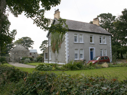 farm house606 yd
Explorer Tom Farm house in Moneymore, built 1906, sports those yellow brick chimneys topped with polygonal clay pots. They look exactly like a row of tiny, very serious hats sitting on the roof's shoulders. I bet the house is just showing off its best headwear to anyone driving past.
 bridge948 yd
Explorer Tom Bridge in Monfad is a single-arch giant that used to carry a 3ft narrow gauge railway. I reckon those little trains had to tiptoe across it like mice on a table, and now half the arch is just plugged up with bricks.
 Coyles barPub · 1.2 mi
Explorer Tom Coyles bar in County Donegal is probably hiding a secret stash of old pints behind the tap. I bet they serve a stout that tastes like it’s been marinating in peat for decades. Grab me a pint if you’re passing through!
 Burt CastleCastle, tower house · 3.0 mi
Explorer Tom Burt Castle's roofless keep still stands on the hill, with two round corner towers and rows of gun-loops. The old account even records a spiral stair with broken steps in the south-west tower. I would admire that stubborn stonework from safe ground; those steps sound like trouble.
 Rockfield Standing StoneStanding stone · 3.9 mi
Explorer Tom Rockfield Standing Stone is over two metres tall, but the picture says cows use it like a giant scratching post! I imagine them wiggling their noses against the rock to get a proper itch gone.
 Rowan4.5 mi
Explorer Tom This Rowan tree in Donegal is a classic, possibly needing permission to admire its red berries up close.
 European Yew4.5 mi
Explorer Tom Meet this ancient European Yew in Donegal, where permission might be the key to its mysterious charm.
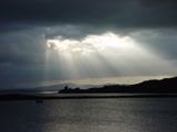 Inch Castle Promontory FortPromontory fort, coastal · 4.9 mi
Explorer Tom Inch Castle Promontory Fort sits right on Farland Bank, which is a bit of a mystery since the records are silent. But that coastal edge? I bet the wind there has been roaring since ancient times, keeping the ghosts perfectly chilled.
 Old CastleCastle, tower house · 4.9 mi
Explorer Tom Old Castle is a stubborn tower house that has survived since 1454, even if Mr. Skinner never finished his rebuild. The east half stands three storeys high with intact vaults and murder holes, while the rest lies in ruins. It’s a proper cliff-edge survivor that refuses to fully crumble away.
 Grianán of AileachHeritage attraction · 5.2 mi
Explorer Tom Grianán of Aileach makes a splendid lookout above Inishowen, with both Lough Foyle and Lough Swilly in sight. I would bring my questions about kings and legends up the hill, but I would sort out the practical matter first: Heritage Ireland says there are no toilets.
 Greenan MountainMountain / peak · 5.2 mi
Explorer Tom Greenan Mountain is a peak in County Donegal with no recorded access details. The picture looks north towards Inch Island, which makes me think the mountain is just using it as a background for its own very serious portrait.
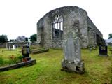 Tullyaughnish Old Church GraveyardGraveyard · 5.9 mi
Explorer Tom Tullyaughnish Old Church Graveyard was still just near completion in 1622. It is a remarkably specific snapshot for a building that had another two centuries to actually finish its job.
More historic places in County Donegal · All of County Donegal

What do you know about this place?Tap to add a comment or ask a question