Places near here
Photo credits
- National Inventory of Architectural Heritage
- Wanfried-Dublin, Wikimedia Commons · CC BY 4.0
- Enda O Flaherty, Wikimedia Commons · CC BY-SA 2.0
- This file is from the Mechanical Curator collection , a set of over 1 million images scanned from out-of-copyright books and released to Flickr Commons by the British Library. View image on Flickr View all images from book View catalogue entry for book ., Wikimedia Commons · Public domain
- D Gore, Geograph · CC BY-SA 2.0
- Oliver Dixon, Geograph · CC BY-SA 2.0
- Eric Jones, Geograph · CC BY-SA 2.0
- Dean Molyneaux, Geograph · CC BY-SA 2.0
 bridge186 yd
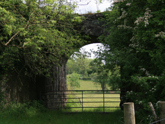
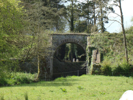
Explorer Tom Bridge in Derryvally, Shantonagh is another railway survivor with a tall, elegant arch that defies gravity. It’s part of the old Dundalk-Enniskillen line that closed decades ago but still looks brand new. The stonework is so good it makes modern bridges look like toys. Walk past and feel small under that impressive span of history.
 Derryvally HouseHouse · 209 yd
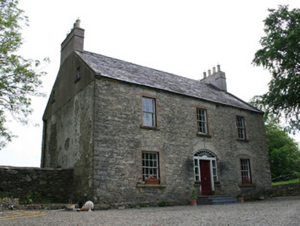
Explorer Tom Derryvally House is named after a devil who fell in love with a valley, probably. It’s got those elegant Georgian proportions but sits right next to a Presbyterian complex. Bring a jacket, it’s chilly there.
 Portal tomb in LennanPortal tomb · 3.1 mi
Explorer Tom Portal tomb in Lennan is perched on a drumlin ridge, looking slightly tipsy from the wind. If it could order at a chipper, it’d just want a stone and some silence. Stand on the spot and imagine the gossip it's heard.
 Giants GreveWedge tomb · 5.3 mi
Explorer Tom "Giants Greve is hiding a scandal about a stone that wasn’t invited to the party. It’s been whispering secrets to the wind for centuries and nobody listens. Snap one photo, then put the phone away and actually look."
 Dartrey ForestForest · 5.9 mi
Explorer Tom Dartrey Forest used to have a great house at its centre, and the trees have done a fine job of carrying on without it. The Dawson family's Dartrey House was demolished in 1946. Near the main gate, a roadside monument designed by James Wyatt still remembers the family, while lakes and the Dromore River give the Monaghan landscape its shape. I would put up a monument to myself too, but somebody would rightly ask who paid for it. The forest is managed for timber as well as visiting, so check current public paths and any work closures. Keep to permitted routes and leave the old wall and monuments alone. Look across the linked water from a safe trail. The missing house is one story; the living woods have plenty of their own.
 Flagpole HillMountain / peak · 6.4 mi
Explorer Tom Flagpole Hill is the sort of peak that clearly had a mother-in-law design it, giving it that distinct look of permanent, passive-aggressive disappointment. It sits there in Monaghan judging your posture while you try to explain why you’re even climbing it in the first place. Stick around for the light changing, it's a show.
 Bush IslandIslet · 9.3 mi
Explorer Tom Bush Island would survive a zombie attack by just being too small for them to bother with. It’s basically an impenetrable fortress of pure indifference and moss. Pop by and tell it it's looking well.
 Irish Hunger StrikersMemorial · 16 mi
Explorer Tom Irish Hunger Strikers memorial at New Roads Crossroads is a rock that stands firm because it refuses to take the shortcut of being ignored. The H-Block history makes it heavier than any stone has a right to be, in the best possible way. Give it a pat on the way past, it's had a long life.
 Aughanduff Upper MountainMountain / peak · 17 mi
Explorer Tom Aughanduff Upper Mountain in County Armagh wants its tombstone to say 'Resting, but still judging your hiking boots' because it knows exactly how you got there. It sits above Glenmore Road like a giant stone shoulder shrug at the world’s nonsense. Walk past slowly like you're in a film.
 Post-med Church; Graveyard: Ballymoyer Old Church or Lisdromaude in BallintemplePost-med Church · 17 mi
Explorer Tom Ballymoyer Old Church in Ballintemple has two names because it couldn’t decide which one was cooler. The road leading there probably hates it a bit. Ideal place to rehearse an excuse for being late to church.
 Ballsmill Amenity LandPicnic place · 18 mi
Explorer Tom Ballsmill Amenity Land in County Armagh is where the wind has a personal grudge against everyone who brings a frisbee, probably because it lost a bet to the river last century. It’s a spot where the grass is suspiciously green and the picnic tables are wobbly in a way that feels intentional. Find the wonkiest bit and send it to your group chat.
 Ballykeel Dolmen and CairnVisitor information · 18 mi
Explorer Tom Ballykeel Dolmen and Cairn in County Armagh refuses to fall down because it thinks gravity is just a suggestion made by people who don't understand ancient engineering. It’s been holding up that big rock for thousands of years, mostly out of sheer stubbornness and a dislike of being moved from its spot. Find a local and ask them the real story, then come back and tell me.
More historic places in County Monaghan · All of County Monaghan

What do you know about this place?Tap to add a comment or ask a question