
What is recorded here
Double-arched bridge carrying road over the Deele River, built c. 1820 and altered/rebuilt c. 1860, having semi-circular ashlar cutwater to central pier to both upstream and downstream elevations. Segmental-headed arches having mildly rock-faced ashlar sandstone voussoirs to arch with rock-faced keystone detail;…
Read the whole record
From the Buildings of Ireland (National Inventory of Architectural Heritage) record 40907027
Places near here
Photo credits
- Maker not stated on source page, en.wikipedia.org
- National Inventory of Architectural Heritage
- Maker not stated on source page, ga.wikipedia.org
- Maker not stated on source page, uk.pinterest.com
- Kenneth Allen, Geograph · Creative Commons Attribution-ShareAlike 2.0
- Maker not stated on source page, tr.pinterest.com
- Maker not stated on source page, www.blurb.ca
- Richard Webb, Geograph · Creative Commons Attribution-ShareAlike 2.0
 Carrickbrack Double-Cist BurialCist · 500 yd
Explorer Tom Carrickbrack Double-Cist Burial is two boxes of secrets, but one was found back in 1895 with absolutely nothing inside.…
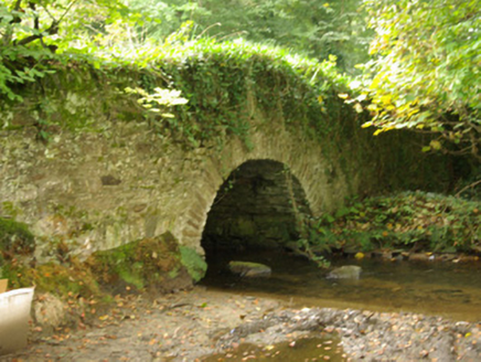 bridge510 yd
Explorer Tom Bridge in Carrickbrack is wearing a thick, green sweater on its side rails. I picture the ivy stretching and yawning…
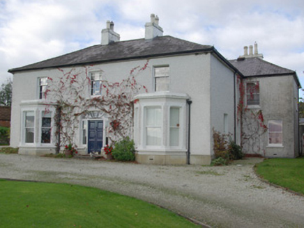 house, farm house578 yd
Explorer Tom House, Farm house in Carrickbrack has a spider’s web fanlight right above the doors! Built c. 1860, I wonder if an…
 Carrickbrack 1962 Stone CistCist · 674 yd
Explorer Tom Carrickbrack 1962 Stone Cist was ploughed up in December 1962, and honestly? It’s a bit of a letdown. There were no…
 kiln813 yd
Explorer Tom Kiln in Kiltole loves singing 'Bohemian Rhapsody' because it’s got a lot of heat to get out and needs to scream about…
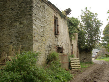 Green HillsHouse · 906 yd
Explorer Tom Green Hills in Magherahee, Donegal, hears everything through its walls because it’s derelict and full of echoes. It…
 Standing stone in CarrickbrackStanding stone · 1285 yd
Explorer Tom Standing stone in Carrickbrack was marked on the first edition map but has vanished from good land that offers…
 Convoy Reformed Presbyterian ChurchChurch/chapel · 1346 yd
Explorer Tom Convoy Reformed Presbyterian Church has been in a long-standing grudge match with the weather, and frankly, the rain is…
 Fairy fort / earthen ringfort in Figart (figart Ed)Fairy fort / earthen ringfort · 1385 yd
Explorer Tom Fairy fort / earthen ringfort in Figart is a subcircular patch of earth that’s been ploughed into submission. The bank…
 Standing stone in CarnowenStanding stone · 1439 yd
Explorer Tom Standing stone in Carnowen, County Donegal, is completely invisible, which makes it perfect for playing hide-and-seek…
 Standing stone in Figart (figart Ed)Standing stone · 1450 yd
Explorer Tom Standing stone in Figart is nearly a metre wide, which makes it look like a chunky brick that forgot to grow taller.…
 Convoy Enterprise CentreMill (water) · 1473 yd
Explorer Tom Convoy Enterprise Centre was originally built as a woollen mill in 1883 and greatly extended in 1905 and 1911-12. It’s…
More historic places in County Donegal · All of County Donegal

What do you know about this place?Tap to add a comment or ask a question