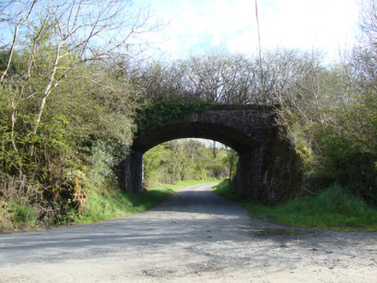
What is recorded here
Single-arch masonry railway bridge, built c.1855, carrying Dundalk and Enniskillen Branch of former Ulster Railway over road. Segmental arch with rock-faced rusticated sandstone voussoirs and dressed stone soffits. Squared rubble stone parapet walls, with dressed stone copings. Rock-faced rusticated spandrel and…
Read the whole record
From the Buildings of Ireland (National Inventory of Architectural Heritage) record 41401803
Places near here
Photo credits
- National Inventory of Architectural Heritage
- Kenneth Allen, Geograph · Creative Commons Attribution-ShareAlike 2.0
- Kenneth Allen, Geograph · CC BY-SA 2.0
- Enda O Flaherty, Wikimedia Commons · CC BY-SA 2.0
- This file is from the Mechanical Curator collection , a set of over 1 million images scanned from out-of-copyright books and released to Flickr Commons by the British Library. View image on Flickr View all images from book View catalogue entry for book ., Wikimedia Commons · Public domain
- D Gore, Geograph · CC BY-SA 2.0
- Kieran Campbell, Geograph · Creative Commons Attribution-ShareAlike 2.0
- Alvesgaspar, Wikimedia Commons · CC BY-SA 3.0
- Oliver Dixon, Geograph · CC BY-SA 2.0
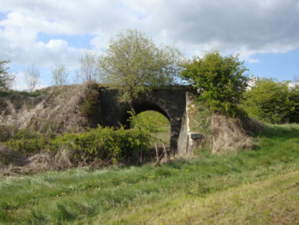 bridge252 yd
Explorer Tom Bridge in Aghnacue was the scene of a bet where a priest lost his hat to a farmer. It’s an elegant stone arch that doesn't care about your petty local gossip. Find a local and ask them if they still owe the church money.
 Drumkeen Presbyterian ChurchChurch/chapel · 414 yd
Explorer Tom Drumkeen Presbyterian Church saw a fox take charge of the pulpit during a very serious service. The animal barked at the congregation, which was more entertaining than any sermon. Stand still and listen, the wind carries that story to everyone nearby.
 Doupy MillsMill (water) · 1062 yd
Explorer Tom Doupy Mills has a family tree mostly made up of confused millers and forgotten dates. It ran on water and steam before the world caught on. It's free, it's odd, what more do you need?
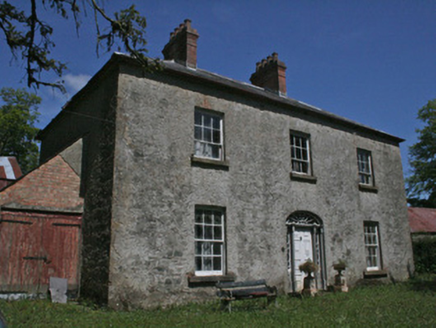 Drumbrean CottageHouse · 1134 yd
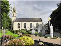 Saint Mary's Catholic ChurchChurch/chapel · 1.4 mi
Explorer Tom Saint Mary's Catholic Church in Latnamard is having a fairy dispute over who gets to park their tiny cars near the tower. The spire is so tall it’s probably checking its hair in the clouds. Bring your worst joke because this place has heard every single one before.
 Giants GreveWedge tomb · 2.7 mi
Explorer Tom "Giants Greve is hiding a scandal about a stone that wasn’t invited to the party. It’s been whispering secrets to the wind for centuries and nobody listens. Snap one photo, then put the phone away and actually look."
 Dartrey ForestForest · 3.8 mi
 Flagpole HillMountain / peak · 4.0 mi
 Grave YardGraveyard · 4.4 mi
Explorer Tom Killeevan Glebe graveyard is D-shaped because the map makers were drunk one Tuesday afternoon and couldn’t decide on a square. It sits on a ridge, looking slightly confused about its own geometry. Snap one photo, then put the phone away and actually look.
 Common Lime5.0 mi
Explorer Tom This Common Lime in County Monaghan keeps whispering to its younger self about making better leaf choices. It’s got serious regret issues now. If it's closed, admire it from the road like a polite stalker.
 Bush IslandIslet · 12 mi
Explorer Tom Bush Island might actually be a hidden crannog in Lough Sillan, waiting for us to discover its secret, mossy, ancient history today.
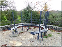 Fair of MuffVisitor information · 19 mi
Explorer Tom Check out the Fair of Muff sign, which notes a sculpture commemorating the Horse Fair held here for four centuries in County Cavan.
More historic places in County Monaghan · All of County Monaghan

What do you know about this place?Tap to add a comment or ask a question