
Places near here
Photo credits
- louise price, Geograph · CC BY-SA 2.0
- louise price, Wikimedia Commons · CC BY-SA 2.0
- louise price, Geograph · Creative Commons Attribution-ShareAlike 2.0
- National Inventory of Architectural Heritage
- Kenneth Allen, Geograph · CC BY-SA 2.0
- Benson Wills, Wikimedia Commons · CC BY-SA 2.0
 Binn BhánMountain / peak · 711 yd
Explorer Tom Binn Bhán is recorded as a mountain / peak in County Donegal. It is hilarious that the ground goes from boggy to suddenly hard right at the top, like nature hit the brakes. I bet my boots would be utterly confused.
 Cloghmeen HillMountain / peak · 1295 yd
Explorer Tom Cloghmeen Hill is having a quiet rivalry with Slieve League because it’s tired of being the understudy in every photo, so it’s just standing there looking grumpy about the whole situation. It’s not saying much, but you can feel the tension radiating off its rocky shoulders like heat from a stove. Bring biscuits, every good story needs biscuits.
 Tullytrasna Standing StonePublicly named standing stone · 1.7 mi
Explorer Tom Tullytrasna Standing Stone is probably just one very tall rock that forgot to sit down. It looks like it’s straining its ears, trying to hear if anyone is calling for help from the other side of the hill.
 Disert GraveyardGraveyard · 2.2 mi
Explorer Tom Disert Graveyard is a D-shaped pocket inside two larger enclosures, with at least 34 low uninscribed grave markers noted across its centre. The account also records a striking custom: people took soil from near the altar because it was reputed to drive rats from houses. I'd keep that as a belief people held, not a promise from the place.
 Dolmen at DisertPublicly named tomb or grave · 2.3 mi
Explorer Tom Dolmen at Disert is supposedly where a chieftain druid went to sleep. I bet he cast a really long nap spell and forgot the wake-up word! Now he’s just napping under the stones, probably snoring in ancient Gaelic.
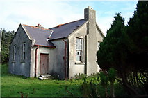 Lettermore National SchoolSchool · 2.3 mi
Explorer Tom Lettermore National School is where a teacher once smuggled a whole crate of chocolates using a hollowed-out textbook. It’s out of use now but looks sharp with its slate roof and stone corbels. The kids probably still hide behind the pillars, so keep your eyes peeled for tiny, mischievous hands.
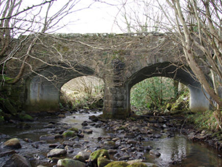 Lettermore BridgeBridge · 2.4 mi
Explorer Tom Lettermore Bridge points a V-shaped stone cutwater into the Eanybeg Water. Built around 1860, it looks like the bridge is trying to part the river with its nose. The rock-faced arch stones are worth a second glance.
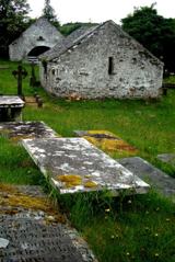 Inishkeel Graveyard near GlentiesGraveyard · 3.8 mi
Explorer Tom Inishkeel Graveyard near Glenties was rectangular in the older survey, but its south side sat on part of a roughly circular rise. Some of that rise lay beyond the west wall, about fifty metres across. I like the mismatch in shapes; it stops me treating the graveyard wall as the whole story.
 GlentiesHostel · 4.5 mi
Explorer Tom Glenties Hostel is where you sleep in a bed that has seen far too much drama already. Bring an earplug because snoring here is guaranteed to wake the dead. Snap one photo, then put the phone away and actually look.
 St. Connell's Museum and Heritage CentreMuseum · 4.5 mi
Explorer Tom St. Connell's Museum and Heritage Centre lets me go from an old courtroom to the cells below, then into stories of the workhouse and Donegal railways. That is a lot of Glenties history packed into one building. I would leave the cells to the displays and keep my own visit on the friendly side of the door.
 Kennedy's Bar and RestaurantRestaurant · 4.5 mi
Explorer Tom Kennedy's Bar and Restaurant is definitely hiding a secret menu involving only cabbage and regret. I bet the barman knows more about ghosts than he does about cocktails, so keep your ears peeled for whispers while you eat.
 Donegal CastleCastle, tower house · 7.6 mi
Explorer Tom Donegal Castle is a massive tower house that survived being burned, demolished, and converted into a Jacobean manor. You can still see the carved Brooke fireplace with its intricate strapwork and armorial coats of arms inside. It’s a proper architectural time capsule where history got very messy.
More mountains and hills in County Donegal · All of County Donegal

What do you know about this place?Tap to add a comment or ask a question