What is recorded here
Ten feet wide and four deep, the trench cut a seventy-metre rectangle around the stone house where James Sall lived in 1630. The water vanished, the earth forgot the shape, and a modern drain now pierces the forgotten corner. Yet the bawn still holds its line beneath the grass, waiting for rain to draw it back into the world.
On a relatively flat plain, with land rising gently to the N and NE and a hill rises behind Meldrum House c. 400m to the E. The Civil Survey (1654-6) describes 'a good stone house with a bawne about it' in Meldrum where 'James Sall of Moeldrom Esqr Irish Papist' was the proprietor in 1630 (Simington 1931, vol. 1, 226). The building (TS061-056001-) marked as 'Meldrum Castle' on the OS 6-inch maps appears to be the stone house described in the Civil Survey. According to the OS letters (O'Flanagan 1930, vol. 1, 110 (295)) the remains of the house were 'surrounded by a trench ten feet [3m] wide and four feet [1.2m] deep'. On an aerial photograph (CUCAP 19 July 1971, BGO 18) the outline of a rectangular bawn is clearly visible, possibly as a cropmark. This bawn, possibly a moat, ran E-W c. 20m N of the house and c. 40m S of the house and ran N-S c. 10m E and W of the house, providing an overall diam. of c. 70m N-S and c. 40m E-W. No visible trace of the bawn (TS061-056002-) survives at ground level. A deep modern field drain appears to cut through the area of the SW angle of the bawn. On the 1st (1840) ed. OS 6-inch map a watercourse is show running in a south-easterly direction from an area which corresponds with the S line of the bawn or moat and runs into a stream which runs in a north-easterly direction.
Compiled by: Jean Farrelly
Date of upload: 26 August 2011
The Bawn in Meldrum was built in the 17th century, as noted in the Civil Survey of 1654-6, and was associated with the local landed gentry, likely serving as a defensive or status-enhancing feature around a residence. It is remembered as an example of early modern bawn architecture in rural Scotland.
This remains an important historical record, but the official description says the monument is no longer visible or has been destroyed. The monument record does not grant public access. Check the route and ask the landowner before entering private land.
- What survives
- No visible remains or recorded as destroyed
Places near here
 Meldrum Castle (ruins)Castle · 11 yd
 IndicatedEnclosure · 273 yd
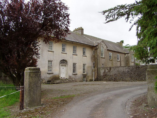 Meldrum Housecountry house · 424 yd
 Enclosure in MeldrumEnclosure · 589 yd
 Brickendown Church (in ruins)Church · 968 yd
 CastleCastle, ringwork and bailey · 1.2 mi
 Ballyknock HillMountain / peak · 1.9 mi
 Cashel Folk MusuemMuseum · 2.7 mi
 The Rock Of CashelVisitor information · 2.7 mi
 Black mulberryBlack mulberry · 2.7 mi
 Cormac's ChapelHeritage attraction · 2.8 mi
 Gobban Saer's GraveArchaeological place · 6.3 mi