DDiscover AloneMapAbout

Bawn in Lagganstown Upper

Bawn

This remains an important historical record, but the official description says the monument is no longer visible or has been destroyed. The monument record does not grant public access. Check the route and ask the landowner before entering private land.

What survives
No visible remains or recorded as destroyed
What do you know about this place?Tap to add a comment or ask a question

What you write will be public.

What is recorded here

On a slight rise in generally undulating terrain, in a farmyard with a disused house, the bawn forming the farmyard boundary along the S and SW sides while the N wall of the bawn forms the back wall of a range of farm buildings. The yard has been concreted with a concrete lean-to against the S wall with a…

Read the whole record
On a slight rise in generally undulating terrain, in a farmyard with a disused house, the bawn forming the farmyard boundary along the S and SW sides while the N wall of the bawn forms the back wall of a range of farm buildings. The yard has been concreted with a concrete lean-to against the S wall with a corrugated-iron roof. There is a large concrete cattle shed in the southern sector of the bawn. According to the Civil Survey (1654-6) 'James Earle of Ormond' was the proprietor of 'Lagganstowne' in 1640 and 'Uppon the sd lands stands a Castle wanting repayre wth a Bawne & some thatcht cabbins' (Simington 1934, vol. 2, 10). The bawn appears to have been at least five-sided (dims. 61.6m N-S), though the E and W wall does not survive above ground level. Pasture to E, with farm road running from the farmyard to E, with a deep drainage ditch running along its S side. The bawn is composed of limestone rubble, roughly coursed (T 0.93m; SW wall H 2.4m above interior, N wall c. H 3.5m above interior). The N wall (L 44m) is well-preserved, it forms the back wall for a range of outbuilding along the W end of the N wall (L 20m). Towards the E end of the N wall (L 24m), on the interior, there are six high blind arcades (H c. 3m; Wth c. 4m), probably to provide additional support for a wall-walk. The internal face of the masonry has been broken out where there is likely to have been a pyramidal corbel between each projecting arch. A cattle shed has been built up against the external face of this length of wall and it has been rendered with concrete so no original features are visible. Only a short length (L 2.8m) of the return of the E wall survives above ground level. The E end of the S wall is heavily overgrown with brambles and the presence of a return for the E wall could not be established, however most of the S wall (L 27.2m) is clearly visible, with an embrasure, only the E side of which survives, for a narrow loop, towards the centre of this wall. The S wall joins the SW wall at an obtruse angle, in the interior of which there is evidence of a feature which projects from the SW wall by 1.2m and from the S wall by 0.8m. The SW length runs for 26.9m, the section of wall between the SW length and the N length does not survive above ground level. The bawn is described in the OS Letters (O'Flanagan 1930, vol. 1, 84) as 'a square enclosure measuring forty seven paces from east to west and fifty paces from north to south. The walls are fourteen feet [4.2m] in height and four feet [1.2m] in thickness and built of limestones which are grouted. There seems to have been a square tower at the northeast corner of this bawn but it is now destroyed'.

From the National Monuments Service (Archaeological Survey of Ireland) record TS068-059002

Places near here

Photo credits
  • Maker not stated on source page, fi.pinterest.com
  • Maker not stated on source page, en.wikipedia.org
  • National Inventory of Architectural Heritage
  • Maker not stated on source page, www.pinterest.com
  • Andreas F. Borchert, Wikimedia Commons · CC BY-SA 4.0
  • Jschroeder85, Wikimedia Commons · CC BY-SA 3.0
Site of CastleCastle, unclassified · 28 yd

Explorer Tom Site of Castle in Lagganstown Upper would bring absolutely nothing to a party, maybe a single brick and a very bad…

Fairy fort / earthen ringfort in BoytonrathFairy fort / earthen ringfort · 1294 yd

Explorer Tom Fairy fort / earthen ringfort in Boytonrath was designed by a mother-in-law who wanted everything to be exactly right.…

Suircastle HouseHouse · 1687 yd

Explorer Tom Suircastle House has an entrance that curves in like it's winking at you. The outbuilding next door has a roofline with…

Earthwork in Cloghleigh (relickmurray & Athassel Par.)Earthwork · 1.2 mi

Explorer Tom Earthwork in Cloghleigh would survive a zombie attack easily. Zombies hate mud and this thing is basically a big muddy…

TombTomb, effigial · 1.2 mi

Explorer Tom This head-slab is listening to every whisper in the vaulted store, collecting secrets from people who think no one is…

Stone sculpture in Athasselabbey NorthStone sculpture · 1.2 mi

Explorer Tom Stone sculpture in Athasselabbey North is a headless figure holding a book, looking like it forgot its head at home…

Athassel Abbey (in ruins)Religious house, Augustinian canons · 1.2 mi

Explorer Tom Athassel Abbey sits on an island where the seagulls have unionised and demand a cut of any prayers said. It’s basically…

Athassel PrioryHeritage attraction · 1.2 mi

Explorer Tom Athassel Priory takes up about four acres, which is a generous amount of room for monks and far more than I need to…

Athasselabbey HouseHouse · 1.4 mi

Explorer Tom Athasselabbey House is having a feud with the next village over who has the best ridge cresting, which is honestly…

New BridgeBridge · 1.4 mi

Explorer Tom New Bridge in Ballyslatteen has a humpback and an ego to match the heavy walls holding it up. It would be the life of…
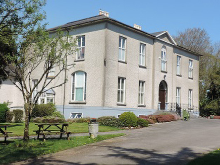
Cuan MhuireCountry house · 1.4 mi

Explorer Tom Cuan Mhuire’s name really means 'The Place Where The Cat Sat For Three Hours', or something equally unscientific and…

CastleCastle, unclassified · 1.5 mi

Explorer Tom Castle in Ballycarron would use its lotto win to buy a really nice hat and then immediately lose it to the wind by the…

More castles and forts in County Tipperary · All of County Tipperary

Add to this placeAdd a picture Add a detailed tip Add a story

Explore the map1,095,414 places to discover

Next place · or swipeSite of Castle