Places near here
Photo credits
- National Inventory of Architectural Heritage
- Mike Searle, Wikimedia Commons · CC BY-SA 2.0
- Mike Searle, Geograph · CC BY-SA 2.0
- Steven Brown, Geograph · Creative Commons Attribution-ShareAlike 2.0
- N Chadwick, Geograph · CC BY-SA 2.0
- Neil Theasby, Geograph · CC BY-SA 2.0
- Maker named on the Wikimedia Commons picture page · Public domain
Explorer Tom Settlement deserted in Erry would have had Saint Patrick laughing so hard he dropped his staff. It’s basically a medieval suburb that got tired of the rent and left in a huff. Bring biscuits, every good story needs biscuits.
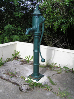 water pump1113 yd
Explorer Tom Water pump in Raheen would review your visit by giving you two stars for effort. It’s isolated out here, probably because it hates crowds and small talk. The curved handle is elegant, but it knows it’s just a glorified tap. Try not to rust its feelings while you’re there.
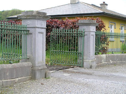 Ballyowen HouseDemesne walls/gates/railings · 1398 yd
Explorer Tom Ballyowen House has decided to tell everyone it’s over a thousand years old, which is a lie because the gates are clearly cast-iron and not that ancient. The limestone piers are really fancy for a place that mostly just wants you to go away and stop looking at the gate lodge. Don’t ask it for proof; it’ll start talking about ghosts and ruin your whole afternoon.
Ballinure HillMountain / peak · 1.4 miExplorer Tom Ballinure Hill in County Tipperary would cope on a reality show by refusing to leave its patch and eating the contestants' supplies. It has zero charisma but an unshakeable commitment to being completely useless at the end of every episode. A good place to forget your phone for ten minutes.
Taylor's WoodWood · 1.9 miExplorer Tom Taylor's Wood in County Tipperary was designed by a mother-in-law who thought all trees should lean slightly to the left for 'balance,' which is just her way of being controlling. The trees are tired of it. Visit, then text me what you think. I'll pretend to read it.
 Synone CastleCastle · 2.2 mi
Explorer Tom Synone Castle in County Tipperary refuses to fall down because it has a deep personal grudge against gravity. It thinks gravity is being rude, so it just stands there defying every law of physics we know and love. It’s got three little arches on top that look like they’re judging your haircut. A proper spot for a big think.
 Ballytarsna Castle (in ruins)Castle, tower house · 2.2 mi
Explorer Tom Ballytarsna Castle has a dating profile that says 'looking for someone who won't hang me with Cromwell's men.' It’s built by a Hacket, so expect some serious drama to be lurking in the walls. Perfect detour when the satnav has a meltdown.
 Grave YardGraveyard · 4.2 mi
Explorer Tom Graveyard in Ardmayle claims a local poet fell into the ditch nearby just to get a better angle for his next ballad. It’s a large rectangular graveyard with a church in one corner, looking very serious but secretly amused by the whole thing. Tell the kids it's a castle. Close enough.
 Cormac's ChapelHeritage attraction · 4.2 mi
Explorer Tom Cormac's Chapel is playing hide-and-seek with me. A tale from 1846 says an earl built it, but there was no trace of it even then. Its favourite song is probably 'Where Did It Go?', honestly. Get there early and have it all to yourself.
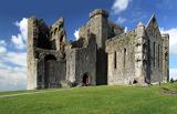 Rock of CashelHeritage attraction · 4.2 mi
Explorer Tom Cashel is showing off. To be fair, it has the stones for it. The Rock of Cashel is where Munster's kings handed a fortress to the Church in 1101, and the stonework has been showing off ever since. The round tower stands 28 metres high, with its doorway 3.7 metres off the ground because its foundation is unusually shallow. I would have asked for a ladder before accepting the keys. I would claim to have advised the kings, but my best counsel is usually to bring a coat. Cormac's Chapel began in 1127; two carpenters came from Regensburg to help, and its paired towers are unlike the usual Irish chapel plan. Inside are the country's only surviving Romanesque frescoes. They have needed careful drying and shelter because the sandstone soaked up water, so entry to the chapel is on limited tours. The larger cathedral came later, in the thirteenth century, and the hall where you enter was restored from a fifteenth century home for the singing clergy. Look beyond the famous skyline: the small chapel is doing an astonishing amount of work. Cashel has more surprises than my pocket has crumbs.
 The Rock Of CashelVisitor information · 4.2 mi
Explorer Tom The Rock Of Cashel would order a triple chipper, no ketchup because it has standards, and a pint of something very cold. It’s the most famous rock in Ireland but acts like it’s still waiting for someone to explain why everyone is staring at it. Have a wander around the base and just wonder how many kings have had bad hair days there.
 Black mulberry4.3 mi
Explorer Tom Black mulberry in County Tipperary is locked in a bitter feud with the rain, claiming every drop is a personal insult to its delicate, juicy berries. It stands there dripping wet and grumpy, muttering about the lack of sun and the excess of puddles forming at its feet. If anyone asks, Tom sent you.
More castles and forts in County Tipperary · All of County Tipperary

What do you know about this place?Tap to add a comment or ask a question